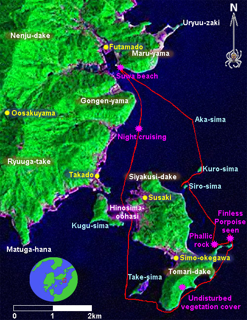
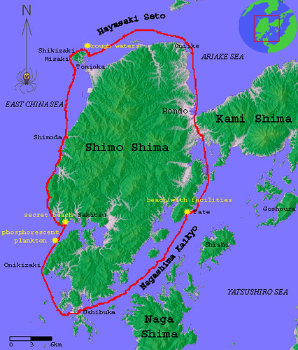
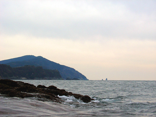
KAMISHIMA CIRCUMNAVIGATION
Total distance- 74km
Length of time- 1.5days
Due to calm conditions this was a fun and relaxing trip.
posted by Leanne and Rik Brezina at
11:28 pm
|
0 comments
![]()
Total distance- 74km
Length of time- 1.5days
Due to calm conditions this was a fun and relaxing trip.
posted by Leanne and Rik Brezina at
11:28 pm
|
0 comments
![]()
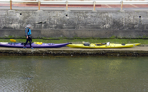
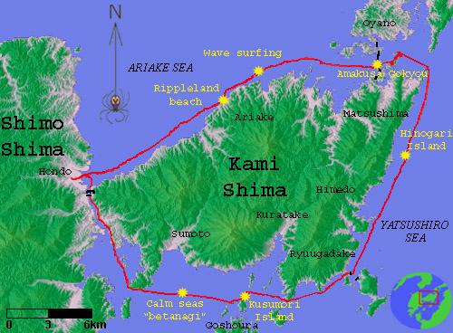
The weather forecast called for calm seas this weekend, so we decided to get our act together and aim for the circumnavigation of the upper island of Amakusa (Kami shima).
Parking our car at work in downtown Hondo City, we paddled down the Machiyamaguchi River to the ocean. Heading northeast we paddled alongside the coast passing one village after another. Time seemed to race by as we got into the hypnotic rhythm of the paddling. In the afternoon a west breeze started kicking up surfable waves in the Shimabara Bay, which speeded up our progress.
posted by Leanne and Rik Brezina at
6:54 pm
|
0 comments
![]()
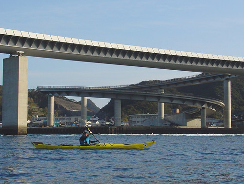
We arrived at the northern part of the island near the "Amakusa Gokyou", the 5 bridges which join Amakusa to the mainland of Kyushu, as the sun was starting to set. In this fairly populated area we searched for an appropriate place to camp. This was not very easy, and finally we settled on an abandoned structure on a tiny island.
The end of March in Japan is the fiscal year end, which means that everyone is busy constructing roads, buildings, tunnels, and bridges - anything to use up the year's budget. By doing this they are ensured an equivalent budget for the following year. On this Sunday evening, unobserved by us during the fading sunlight, on the neighboring island there was a project in the works and jack hammering rattled far into the night. So much for the romantic visions we had about camping on an uninhabited island.
posted by Leanne and Rik Brezina at
6:52 pm
|
0 comments
![]()
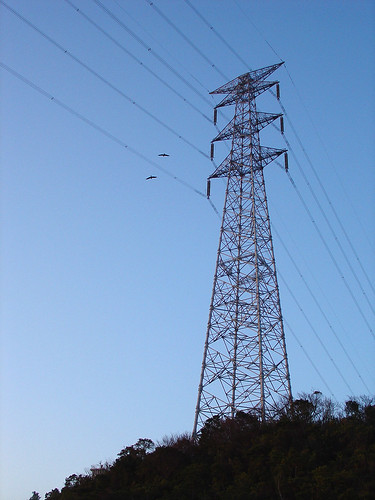
We woke up bright and early and after rounding Shimoootonomisaki, the northernmost point of Kami shima, we watched the sunrise above the mountains of central Kyushu beyond the Yatsushiro inland sea. Here one can also admire the highest steel tower in Kyushu.
posted by Leanne and Rik Brezina at
6:51 pm
|
0 comments
![]()
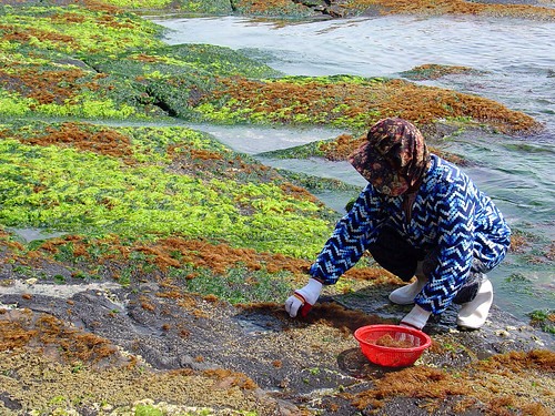
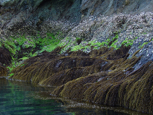
Stopping for a break we noticed a grandma picking seaweed. She explained about the various seaweeds and how to eat them. She also said that her daughter in law was also a foreigner- a Philippine woman. Such a thing is actually quite common in the depopulated areas of Japan, there are even organized tours abroad for men to look for potential brides.
posted by Leanne and Rik Brezina at
6:50 pm
|
0 comments
![]()
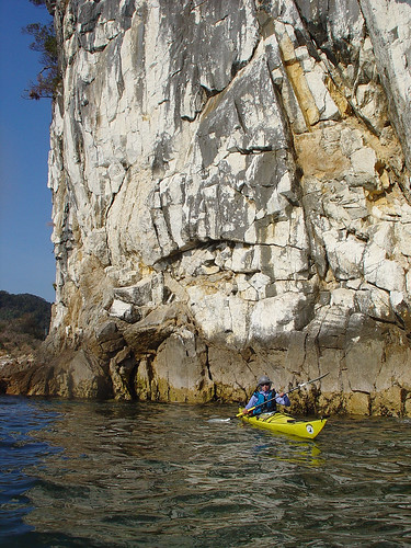
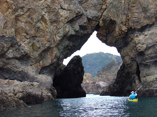
Today was going to be a demanding 45 km day. The weather was clear, bright and warm. Spring is here! The smell of the mountain flowers was hanging in the air whenever we passed close to land. In Himedo town, we passed Uryuuzaki, which sports the best-looking cliffs in Amakusa. If you look closely you will understand why we have started sea kayaking- the rock is fairly rotten and unsuitable for rock climbing.
posted by Leanne and Rik Brezina at
6:49 pm
|
0 comments
![]()
posted by Leanne and Rik Brezina at
6:48 pm
|
0 comments
![]()
posted by Leanne and Rik Brezina at
6:47 pm
|
0 comments
![]()
posted by Leanne and Rik Brezina at
5:31 am
|
0 comments
![]()
posted by Leanne and Rik Brezina at
1:12 am
|
0 comments
![]()
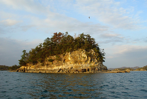
View from Kuroshima looking north. The mountains seen are Jiromarudake, Shiratake and Tsuwadake.
Also visible is Uryuuzaki and Akashima.
posted by Leanne and Rik Brezina at
1:11 am
|
0 comments
![]()
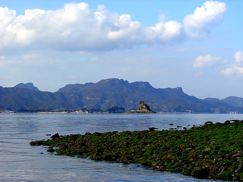
Beds of seaweed cover the rocks of Akashima.
posted by Leanne and Rik Brezina at
12:50 am
|
0 comments
![]()
posted by Leanne and Rik Brezina at
12:33 am
|
0 comments
![]()
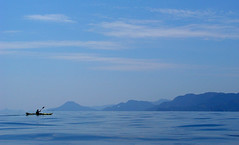
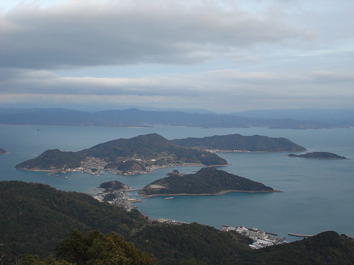
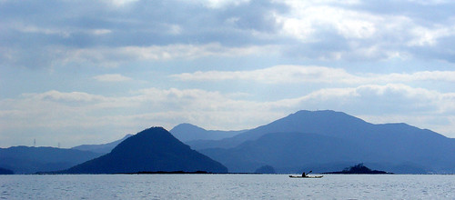
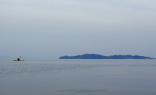
Paddling across Miyazu Bay with Takamoku Island and Mt.Oidake on Kami Island in the background.
posted by Leanne and Rik Brezina at
2:50 am
|
0 comments
![]()
Fondly refered to as "Onigiri Shima" or "rice ball island", this half quarried Island is an obvious landmark.
posted by Leanne and Rik Brezina at
2:33 am
|
12 comments
![]()
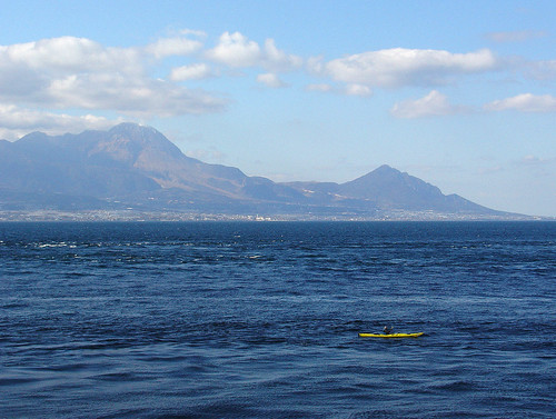
How did I get myself into this fast current AGAIN! Once again, the backdrop for this scene is the ever spectacular Mt.Unzen.
posted by Leanne and Rik Brezina at
2:26 am
|
0 comments
![]()
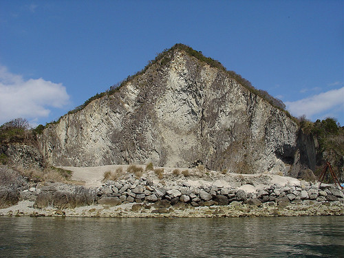
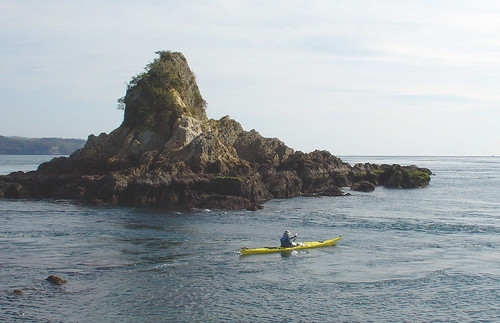
Habo Island- a volcanic island with interesting rock formations.
posted by Leanne and Rik Brezina at
2:25 am
|
0 comments
![]()
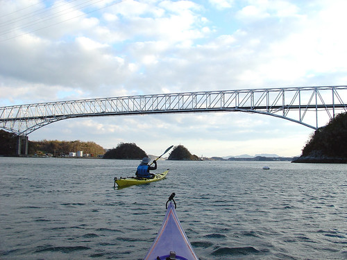
Tenmon Bridge is the 1st of the five famous Amakusa bridges.
posted by Leanne and Rik Brezina at
2:24 am
|
0 comments
![]()
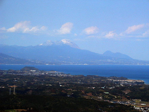
"Yuki Geshou" is an expression that means scenery lightly dusted with snow.
Every morning we have developed a ritual of looking out from our balcony in order to assess the weather and the condition of the air and the sea. This morning we were greeted with a snowy view of Mt.Unzen.
posted by Leanne and Rik Brezina at
12:03 am
|
0 comments
![]()
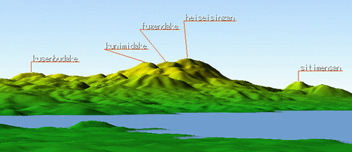
Mt. Unzen, is the volcano located east of Nagasaki city, and north of Amakusa. In was last active in the 1990's, when a new dome was created to form the now highest summit known as Heiseishindake, 1486m.
For more information about Unzen in English:
http://volcano.und.nodak.edu/vwdocs/volc_images/img_unzen2.html
This image was made with the software "Kashmir".
posted by Leanne and Rik Brezina at
12:01 am
|
0 comments
![]()
Total distance- 117km
We started the trip on Sunday afternoon after our school open house and finished on tuesday morning before school.
posted by Leanne and Rik Brezina at
3:10 am
|
0 comments
![]()
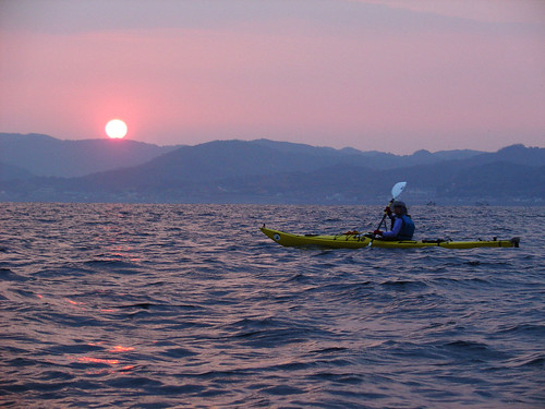
Magic sparkles coat my paddle and kayak, under the starlit sky I feel like a sorceress. I am at the mercy of the waves. I feel so small, like a piece of driftwood, being thrown one way and then the other by the waves and the current. The sky is full of stars, and I am so small on the water. I am overwhelmed with awe.
The day had been beautiful and the night was even finer. We traveled up the southwestern coast by starlight. As we paddled for hours in the serene landscape so many thoughts raced through my head. My friend's lives, politics, religion, my students, Japanese dancing, and the books I have been reading. It's amazing where your mind wanders to when you are paddling endlessly through the water.
posted by Leanne and Rik Brezina at
3:10 am
|
0 comments
![]()
The day had gone by effortlessly, cruising down the fast current south along the western shore of the island.
posted by Leanne and Rik Brezina at
3:03 am
|
0 comments
![]()
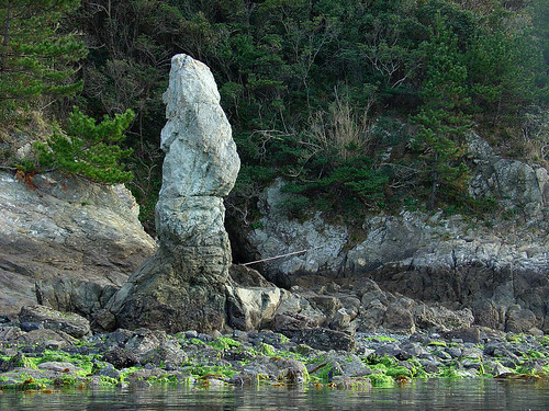
Rounding the islands southern point, we paddled under the Ushibuka Bridge. This huge and unneeded bridge is a symbol of the exorbitant construction budgets that fuel the Japanese economy.
posted by Leanne and Rik Brezina at
3:02 am
|
0 comments
![]()
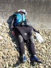
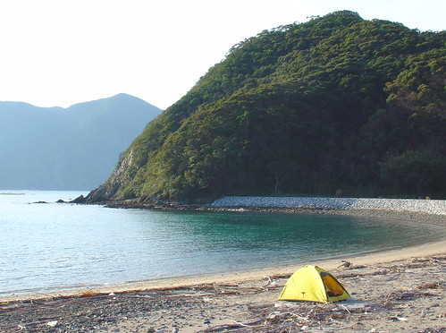
That night we camped at a beautiful beach near the town of Sakitsu. The clear night brought cold temperatures as the mercury dipped to around 0. While we were paddling we were not especially cold, but the moment we stopped we quickly became frozen. The beach was littered with driftwood, which came in handy to build a bonfire. On this fire we roasted dried rice cakes (mochi) until they were brown and swollen. A delicious meal followed and we quickly gobbled down like a couple of wild boars in a vegetable garden.
That night due to a slow leak in my thermarest, I froze and woke up not feeling especially fresh.
posted by Leanne and Rik Brezina at
3:01 am
|
0 comments
![]()
The next day we slept in a bit since we had an easy day ahead. The forecast called for light wind and 0.5m waves, so our planned itinerary should have been a piece of cake. As we set off to enjoy our easy day we were blasted with a sharp north wind. The waves were also much bigger than anticipated. Our progress at times slowed to 1.5km/hour. At this rate we would never make it. Gone were my wandering thoughts of the past day. In its place I felt an urgency to arrive at our goal in one piece.
posted by Leanne and Rik Brezina at
3:00 am
|
0 comments
![]()
It was almost completely dark; the last glow of sunset was slowly fading on the southwestern horizon. We were going around Shikizaki misaki (a cape on the north west tip of Shimo shima). We had planned to paddle for 2 hours past sunset. This way we would catch the fast moving current flowing at 7km/hour (the ocean expressway) and arrive at our camp destination set up nicely for the final push home in the morning. Everything seemed doable; the sea seemed calm and manageable. Suddenly as we went around the cape the waves were big and irregular, I couldn't see, I was struggling to keep control, to overturn at this moment in time was not an option, I had to keep it together. I was hyperventilating, my heart was pounding, Rik called to me to make a sharp right turn, we had to zigzag through the waves toward the sheltered side of the promontory. Keep it together, relax, you are almost there, paddle hard get out of this mess. Finally calm, tranquility, we were out of the rough waters. That's enough for this day, let's set up camp, eat some grub and get to bed.
posted by Leanne and Rik Brezina at
2:58 am
|
1 comments
![]()
We were blessed with a hard sleep after the traumatic event of the evening before. The morning greeted us with a slight north wind, a calmer sea and a hazy sky. Our bodies felt achy and my hands were sore, probably from over-gripping my paddle out of fear. Unfortunately since the previous day was cut rudely short, we were forced to make up the distance to make it back to our starting point before our workday started at 3:00. Out we dashed into the fast moving current and cruised on our way. Time was at a premium however. We were left with a dilemma. We could hoof it back (in our exhausted state), hopefully encounter no problems and then arrive with seconds to spare in time for work. Of course that plan was ditched, Plan B was put into action. I docked in Hondo, leaving Rik to sprint the extra 15 km back to our car.
That day at work we were on a high, the exhaustion didn't hit us until the next day and the whole next week.
posted by Leanne and Rik Brezina at
2:57 am
|
0 comments
![]()
Gaijin in Japan

Canadians teaching English in Japan

 Subscribe in a reader