Gumbies

Tuesday, September 13, 2005

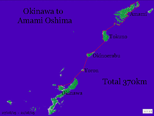
Okinawa to Amami traverse PART 2

akatsuchi
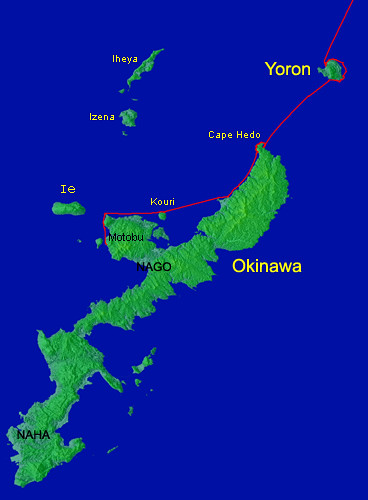
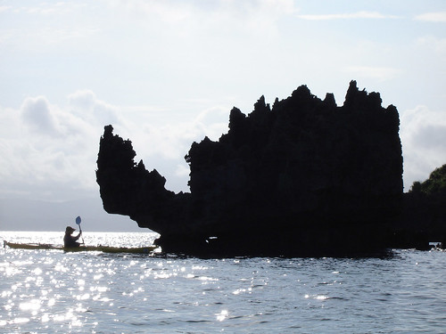
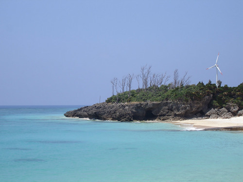
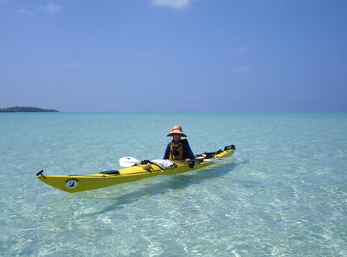
Guided by channel lights, we slipped past the edge of Yoron’s reef in the pre-dawn darkness early the next day. Beyond 34km of open sea lay Okinoerabu island: slightly larger and taller than Yoron and for many centuries the northernmost land of the Ryukyu kingdom. When finally seized by the Satsuma domain of Japan, this remote island with unpleasant and harsh living conditions was used to exile prisoners, the most famous of which was Saigo Takamori, the true Last Samurai. After the seven-hour crossing, which went by uneventfully, we had impatiently followed the coastline looking fruitlessly for any place to cross the reef and its relentless surf. We had eventually pulled ashore at the new, ugly, and grossly oversize Sumiyoshi fishing port.

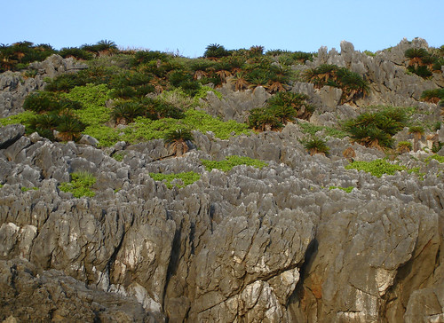
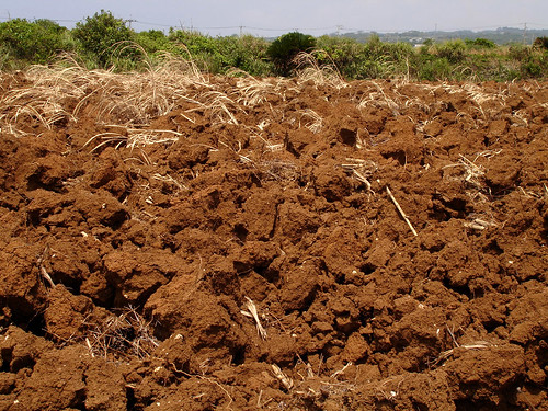
Today, the island's inhabitants struggle to make a living growing sugar cane on the island’s barren ‘akatsuchi’, or red soil. Water is scarce, and in the summertime it only rains during typhoons, which of course wreak their own damage on the crops. There had been no typhoons yet this year, and the land was hot and parched as we walked the kilometer or so to the tiny town of Sumiyoshi (Good Living).

kuragou


kuragou1, originally uploaded by vibromama.
Disappointed, we found no store or functioning restaurant in the dilapidating, dusty town. A construction crew was busy widening the main road, perhaps so that future travelers can pass more quickly and let the town desiccate in peace. At least there was a vending machine by the post office. But our erstwhile pointless detour was finally consummated when we found the Kuragou – or Dark River. This was an underground river located at the bottom of a deep natural chasm in the middle of town, doubtless the original reason for the town’s existence. Here, Leanne is admiring the impressive wild hanging garden which graces the lip of the chasm, soaking up the moist air rising from below.

taminasaki


taminasaki, originally uploaded by vibromama.

Grey limestone bluffs of bizarre form make up the Yagoniya coast on the west side of Okinoerabu. They start out small on the south end but gradually they grow in height, until they culminate at about 50 meters in Tamina Cape, a place where powerful natural energies seem to be concentrated. Under their mysterious influence, we would be spending here the whole next day and night.

okidomari


okidomari1, originally uploaded by vibromama.

This idyllic-looking campsite is on a public beach called Okidomari. The beach has full facilities but is free for the citizens to use. With few visitors, it’s mostly the town locals that use it and it was obvious no one would mind us camping right on the beach, though there is also a free campground set up invisibly in the bushes above.

striped_fish

Okidomari has a reef with a channel (and another ugly but convenient new port); it is a good spot for snorkeling.

umigame

That night at high tide as we were cooking dinner we heard a rustling nearby. As it was already dark we searched around with our headlamps and discovered to our delight two freshly hatched baby sea turtles. They must have been attracted to our bright lights. We quickly turned off our lights and watched them shuffle down the beach to the sea and get picked up by a wave. Off into the great unknown!

taminaview


taminaview, originally uploaded by vibromama.

A bit worried about the next day’s alignment of wind, waves, and currents, as well as to relieve our sore wrists and rotting feet, we took the day off island-hopping and walked the farm roads to the cape, where a majestic sweep of sea arcs under a big sky. On a very clear day, we’re told, Okinawa’s Ieshima near our departure point 3 days ago can be seen from here.

tsumugi


tsumugi, originally uploaded by vibromama.

A nondescript concrete building situated on the apex of the cape housed what looked like an art shop, so we walked in. The place displayed an interesting collection of traditional folk equipment of all sorts, as well as seashells, fossils, and the like. Beautiful silk garments made with the Amami ‘tsumugi’ cloth billowed in the gentle breeze. A peek in an adjoining room revealed a loom and more fabric and clothes.

fabric2
fabric
We had unwittingly walked into the studio and home of a local artist and admired the things within for a full 20 minutes when to everyone’s surprise he suddenly walked in from an adjoining room. It always happens by accident, but we seem to have the luck everywhere of running into the local staunch environmentalist. After we apologized for intruding, the artist (who designs and makes the garments completely by hand starting from raw silk) proceeded to show us around. We admired his use of patterns found on seashells or the colors of the sea at sunset. A 3-hour conversation ensued, turning quickly to the problem of the environment. If we had any delusions left about these islands being remote enough to be spared the usual destruction, they were quickly dispersed. I suppose we had already noticed that the waterfall and its stream by our campsite smelled a bit like sewage, but maybe we just tried to ignore it. Now we were told that the entire delicate aquifer of the island is thoroughly polluted, and most people drink bottled water. The waterfall above our camp actually had fully formed only after water had been diverted into the local village. Kuragou, the underground river in Sumiyoshi, is also polluted. Lack of sewage treatment and over-fertilization of the porous, infertile soil are the main causes. Some species of shells have disappeared over the years and fish are becoming scarce. More farmland is being developed, and forested areas along the island’s rim, which provide a natural wind barrier during typhoons, are being cleared. Many native trees are dying, a sight we had indeed witnessed the day before. The new port, of course, is not needed and its building had been opposed by many local citizens. Everywhere, it seems like it’s the same story.

friends


friends, originally uploaded by vibromama.

My unsuccessful efforts to get our stupid cell phone email to receive detailed weather forecasts sent to us by our kayaking friend Kenji Suemitsu were soberingly interrupted when I walked barefoot into a wad of barbed wire. Back at the lighthouse later that night, shuffling on perforated feet had me alert for the 3rd annual Yagunya Cape Festival, held by coincidence during our brief stay in Okinoerabu. Showcased were local talents singing, dancing, and playing traditional instruments. A lively contingent of Filipino imported brides performed dances of their own and a group of elementary school students who quickly become our best friends did a dance with their enthusiastic teacher.

tokunosima


tokunosima, originally uploaded by vibromama.

The next day we wistfully departed Okinoerabu. Though we only planned to move a bit up the coast, the day seemed too good to waste and after a vending machine break at the port of Inobe we began the longest traverse of our trip: 41km to Tokunoshima. A favorable south wind was blowing but the relentless current kept dragging us back and left. It was quite strong at first and it seemed to take a long time to clear Okinoerabu’s northeast Cape Kunigami. As the island gradually receded, however, the current veered and weakened, and our progress became faster. The mountains of distant Tokunoshima had been visible all day and hour-by-hour, they grew more defined. About halfway across, I spotted a single fin slowly following Leanne’s boat at a few meters’ distance, “Jaws” style. She had been singing traditional Okinawa and Amami folk tunes and the animal (be it shark or dolphin, we’ll never know as it scuttled on my definitive approach) might have been attracted to the vaguely yodel-like sound. Leanne carries tablature in her map case and often sings to relieve the boredom of many hours’ paddling to nowhere. Today further singing was discontinued as a precaution. We were also more alert than usual splashing around in the water during the mid-ocean pee breaks. In the late afternoon, approaching Tokunoshima on a swell from yet another distant typhoon, it became obvious we would not make landfall by dark; but heading toward a fishing port, we were able to land safely.

Tuesday, September 06, 2005

Typhoon 14


Typhoon 14, originally uploaded by vibromama.

No kayaking today! Today Hondo City found itself in the eye of powerful Typhoon 14. The violent northeast winds peaked out exactly at high tide and big waves had no trouble splashing over the main sea wall of Hondo Port. Garbage floated down the river and the smell of overflowed sewers assaulted our senses along with the windblown seawater and rain.

Saturday, September 03, 2005

Okinawa to Amami traverse PART 1


Okinawa to Amami traverse, originally uploaded by vibromama.

Anyone who has studied an atlas of the world in some detail must have noticed there are many places on the map that seem custom made for the adventurous traveler. There are usually broad geological or political reasons for this, but the all-important details seem to be left to accident. Through our many years of rock climbing, we often contemplated how an otherwise blank rock face comes to have a line of holds just big enough to be climbable, presenting a natural line that is often more intriguing than the best artificial routes constructed in indoor climbing gyms. Japan’s Nansei Shoto or Southwest Archipelago – the long chain of islands stretching in a graceful arc from Taiwan to Kyushu, is one such natural route of great interest to the sea kayaker. Historically, these islands formed a trade link between Japan and China, and the kingdom of Ryukyu flourished here for centuries in a delicate balance in spite (or maybe because) of the islands’ small size and the fact Japan and China were not usually on speaking terms. The entire Taiwan-Kyushu traverse is a major undertaking (to our knowledge not yet accomplished in a sea kayak) with, for example, a 220km gap between Miyako and Kume islands southwest of the largest island of Okinawa. This kind of thing being beyond the scope of our 2-week summer vacation, we opted instead for the easiest section between Okinawa and Amami, the other large island in the chain. Here the islands are nicely strung together, the distances between them never more than 40km, and the currents, while troublesome, are not as strong or complicated as elsewhere. A little worried about the weather (it was already typhoon season) but quite excited to experience the differences between the individual islands, we loaded the boats onto our minicar and headed to the southern Kyushu port of Kagoshima.

Okinawa to Yoron map1


Okinawa to Yoron map1, originally uploaded by vibromama.

crew


crew, originally uploaded by vibromama.

Getting the kayaks on the ferryboat has always proved interesting. Kayaking is (incredibly) still such a rare sport in this rich island nation that the word “shii-kayakku”, though now officially Japanese, has not yet registered in the common vocabulary and even “kanuu”, which we guess means any kind of small boat, not only a canoe, often produces blank stares on the faces of the ferry personnel. This time the commotion culminated as the entire dock crew gathered to box up the boats. When we explained we wouldn’t be needing our car because we’ll be paddling halfway back from Okinawa, they exclaimed: “Yuu aa kureijii!”.

sakurajima


sakurajima1, originally uploaded by vibromama.

The active volcano of Sakurajima dominated the view as the ferry pulled away from Kagoshima port. This mountain covers the city daily with a thin layer of abrasive ash that ruins shiny car lacquer and windshields, dirties clothes drying on a line, and probably causes uncountable cases of respiratory illness. These are minor inconveniences the Japanese are quite willing to put up with, though things will be different if the volcano explodes and covers this thriving city with several meters of hot ash and rocks; according to geologists this is not at all an unlikely scenario.

giantcrab


giantcrab, originally uploaded by vibromama.

A full night and day was spent on the ferry rolling in the swell produced by a typhoon just then traversing between Taiwan and Shanghai. We left in the evening and by dawn the next day we arrived at Naze, the main city on Amami, which was to be our paddling destination. Then, as the day wore on, the ferry hopped the island chain southwestward; we observed the sea and land carefully gleaning various clues helpful to our journey. Finally, about an hour before sunset we disembarked in Motobu, a small port in northwest Okinawa. We slid the boats into the lukewarm sea and paddled into the night toward a small, uninhabited island where we had seen a possible campsite from the ferry. The place was fine; we soon set up the tent, ate dinner and fell asleep.

We were up and packing an hour before dawn, when we discovered a couple of these creatures snacking on our supplies of dried fruit and nuts. These cute critters are giant land crabs and are about the size of large lobsters. They are slow and basically harmless, and dexterous enough to open pockets with flaps. We were delighted to be sharing the island with these native inhabitants and leaving a few morsels behind, we paddled off toward the breaking dawn.

kourijima


kourijima, originally uploaded by vibromama.

The southern islands (up to parts of Tokunoshima) are made of limestone and dolomite that comes from ancient coral reefs, even as new reefs grow around them. The sea sculpts these rocks into bizarre, ever-changing shapes that delight the eye of the paddler-by.

underwater


underwater, originally uploaded by vibromama.

Stopping for a snorkeling break, we saw a sea snake (venomous but non-aggressive) and a playful puffer-fish. On a rock near the coast, we encountered a noisy colony of graceful seabirds.

Friday, September 02, 2005

hedo


hedo1, originally uploaded by vibromama.

Close to sunset, with 55km of sea already under our paddles, we arrived at the rocky Cape Hedo, the north tip of Okinawa. Here, towering limestone cliffs 100m tall overhang the sea. Several kilometers of cliffy coast with interesting rocks, coves, and caves lit up by the day’s final burst of sunshine provided a beautiful finish to a long, tiring day. We saw several sea turtles near our boats, some nearly a meter long. Though we later realized these creatures are quite common here (they are fairly rare in Amakusa), seeing one somehow never became commonplace, and we would call out to each other: “Turtle, 11 o’clock!” so we could both catch a glimpse before it would dive.

chijizaki


chijizaki, originally uploaded by vibromama.

The first open sea traverse awaited us the next day: 24km to the south shore of Yoron Island. Starting into a ripply sea an hour before dawn, it was already hot and stuffy when the low island became barely visible ahead through the day’s humid haze. The traverse was easy but monotonous and hot testing our morale. Contrary to our expectations, each of the four traverses on our route turned out to be quite different in character. This one was perhaps psychologically the most difficult, and as we slowly approached the coastal bluffs, it seemed that although they gradually gained form, the shore was not getting any closer. Slowed by a current from the left (which turned out to be a permanent feature of all the crossings) and thwarted by waves a bit too large to allow a landing, we skirted the coast until we found an artificial channel through the reef that led into a fishing harbor. Finally landing on a picturesque beach, we at once realized we’d come to one of the most beautiful islands in Japan.


yurigahama, originally uploaded by vibromama.

Inside the wide shallow lagoon formed by the reef, it was easy to round the southeast corner of Yoron. After a stop at an unpretentious beachside restaurant, we headed about a kilometer off the east coast to Yurigahama, an extensive area of shallow water and white sand. Low tide had exposed the sandbar in some places, and a jet-ski was seen towing a few beachgoers there on an inflatable contraption (kayaks were once for rent, we were told, but these were not very popular since they were “too slow”). The water was crystal clear, and the bright, shallow sea stretching out far around us was a delight to behold.

snorkel


snorkel, originally uploaded by vibromama.

Eventually we meandered toward the outer edge of the reef, just exposed by the low tide. Seizing the opportunity, we pulled up the boats, donned snorkeling gear and dove in between the waves on the ocean side. The clarity of the sea was such as we had never seen before – rocks maybe 50 meters away were visible under water and diving felt like floating through air. A bewildering array of fish of all shapes, sizes, and colors were swimming about the bizarrely sculpted ramparts of the reef. Sea turtles cruised by nimbly, and large sea snakes wound about unhurriedly. Wanting to stay longer, we reluctantly returned to the boats as they were about to be set free by the rapidly rising tide.

Considering the jaw-dropping beauty of Yoron’s sea, it was a little surprising that we saw so few tourists here, at the height of Japan’s beach-going season. Later that evening, at a small noodle shop in downtown Chabana (Yoron’s main town, whose romantic-sounding name – Tea Flower – belies its utterly ordinary concrete-block demeanor) explained to us the reality of Japan’s tourist trade. Yoron had indeed been a popular destination years ago when all points south were still in the hands of the Americans and this had been Japan’s southernmost island…more than because of its natural beauty, the tourists flocked here due to this trivial fact. (Now, tiny Haderuma island about three degrees of latitude further south and west enjoys that privilege, and there is indeed a monument there in front of which visitors do line up for the obligatory photos.) Besides, now the American dollar is three times cheaper than it was then and everyone goes to Hawaii, where a similar beach is likely to be crowded by a thousand people. But the prestige of going overseas for the Japanese outweighs such trifling details. Thus the wandering gaijin in Japan may happen upon one gem of a place after another, hardly meeting anyone along the way. Planning our camping places before departure, we had thought it better to avoid any beaches specifically mentioned on the Internet, since such places here in Kyushu often prohibit camping or else charge exorbitantly for it. Although 215 other suitable beaches along our route were dutifully geo-coded from topographical maps (available freely online), this kind of thinking was turning out to be completely unwarranted. No one ever minded us camping anywhere: public beaches or the convenient flat concrete of the fishing harbors.


Subscribe in a reader
[View Guestbook] [Sign Guestbook]