Start: Oct 8th, 1402h
Finish: Oct 9th, 1448h
Distance traveled: 176km
Average speed: 7.2km/h
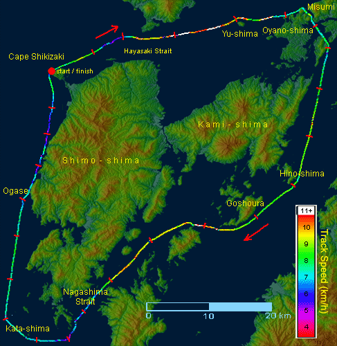 The course of the complete Amakusa circumnavigation. The shortest possible course (not shown) is about 172km in length; it ought to be negotiable in less than 24 hours. My own track is colored according to speed of travel, and the red ticks indicate my hourly progress.
On the weekend of Oct. 8th, the weather and tides cooperated to create workable conditions for re-attempting a circumnavigation by kayak: 172km around the complete archipelago, including all outlying above-water and drying rocks. The idea to do this occurred to me when doing the circuit of Amakusa’s largest Shimo Island earlier this year: this 117km tour took 16hours. Re-checking the geography and nature of the sea currents, it then seemed that a 24-hour tour of the entire group was possible. My first attempt took place on September 10th; because of the prevailing winds I chose the somewhat less favorable counterclockwise route, with a pre-dawn start from the city of Ushibuka in the south. The attempt ended in a miserable failure, mostly due to stronger than expected winds, which made me 2 hours late at the strategic Misumi Strait in the north-east. “Time and Tide wait for no man”, it is said, and so it was: there was no point in continuing as I would encounter impossible currents later in the Hayasaki Strait. I had borrowed a friend’s lightweight kayak (thanks, Ushi-kun!), which I test-paddled to find 3 or 4% faster than mine, but in large waves and strong tailwind, the unstable boat became a liability as I beat a long and laborious retreat to my home port of Hondo, including a couple of unplanned baths in the still lukewarm sea. In retrospect I arrived home more exhausted than I would have been had I made good time and was able to finish the entire circuit.
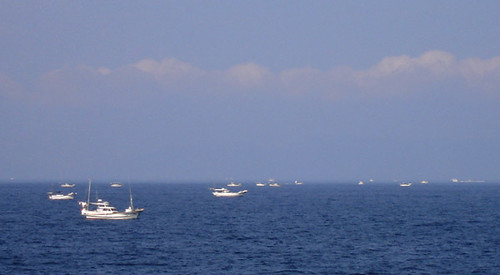 Fishing boats crowd the Hayasaki Seto. The boats take advantage of the fast currents (somehow) to catch more fish.
 So here I was in Ushi-kun’s boat again, this time at Amakusa’s north-west extremity of Cape Shikizaki, on a beautiful, sunny mid-afternoon. The sea was calm as I set an easterly course toward the inland seas. Porpoises and dolphins were seen here and there breaking the glassy sea surface. As it was Sunday, freight traffic was low and I had the whole Hayasaki Strait to myself as I caught the beginning flood current; soon I was moving at more than 10km/h toward the distinctive Yu-shima and Misumi mountain in the distance. I was on a strict schedule, which, if met, would complete the circuit in 22h 40min. Thus I had 1h 20min to spare for the 1-day tour. At Yushima, as the red sun sank beneath the horizon, I was 15minutes behind time; this was due to an apparent late start of the flood current at Hayasaki. Anyhow, it was nothing to worry about – yet.
But now night had fallen and the wind and waves picked up. Ushi-kun’s boat is not so bad so long as one heads into the wind, which is what I was now doing. The strong currents opposed to the wind kicked up higher and higher waves; I was now soaked but quick checks of the GPS showed I was flying forward. Busy with the waves, I nevertheless noticed a light quickly moving toward me; checking we were not on a collision course, I focused again on the waves. It was the “Marinview”, a high speed ferry connecting Kumamoto and Hondo, on its final run. Around this time I wandered a little too far to the south; perhaps I was subconsciously being pulled away from the rough waves toward the shores of Oyano Island to starboard. Anyhow, suddenly I was in calm water but alas, my speed had dropped also! I contemplated whether to go back into the high-speed maelstrom or sacrifice some time in relative safety. I chose the latter option and by the time I reached the Misumi and Zozo Straits, I had tacked on another 25 minutes to my tardiness. I would have to work extra hard in the next 8 hours to make the Nagashima Strait before the current turned against me there and stopped me in my tracks.
For sustenance, I carried a large bag in my cockpit which contained: 2 liters of sports drink, 3 liters of Coke, 3 uniquely Japanese ‘energy drinks’ (noxious concoctions which overworked businessmen guzzle in the belief they will be somehow energized; they are actually the main source of revenue for Japanese pharmaceutical companies, who seem to have a monopoly on their manufacture), 15 jell-packs (at 170 calories each and about a 10-second consumption time, these are one of the fastest ways of ingesting nourishment), 5 Snickers bars, 5 tubes of sweetened condensed milk, one pre-made spaghetti-salad. All this amounted to about 7000 calories and though I didn’t feel particularly hungry or thirsty at any time, I force-fed myself at regular intervals to maintain an adequate energy level. (Incidentally, though I partook amply of McDonalds, KFC, and pizza the night before, and inhaled all the above food and drink, I lost 1.5kg during the trip.) Calls of nature were satisfied using the usual bilge sponge, though through careful rationing of liquid I only had to go twice.
Sucking up a jell-pack or two, I tried not to stop paddling for long. A long stretch of the Yatsushiro Sea now presented itself beyond the bow. I tried to allay boredom by listening to the radio, but the music only seemed noisy and the best moments occurred between the songs when the quieter sounds of the sea again reached my ears. So I put the earphones away and paddled on. A full moon climbed high into the sky, and there was no problem seeing where to go. When my energy again began to wane, I tried an energy drink, but all it did was give me an upset stomach. A slug or two of Coke, on the other hand, and the speed indicated on the GPS jumped up so suddenly I had to stop and make sure I did not hit a current. Coke is it!
In the pre-dawn hours I rode the ebb tide through the Gannoshiri, Hachiman and Nagashima Straits. This is normally a busy shipping route; I was now criss-crossing it at will to cut distance and to ride the fastest currents. At night the lack of freighters gives one this freedom. At Nagashima Strait I had shrunk my delay to only 25 minutes, but even so the flood current had already started, slowing me down considerably for the next 15km.
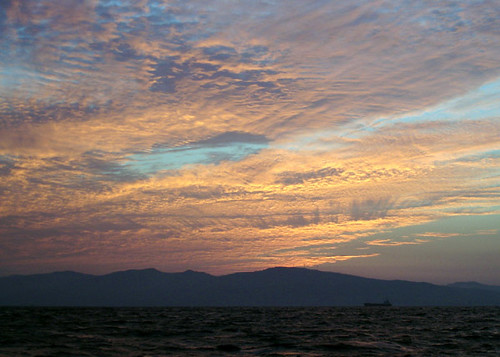 The sun is about to rise over the hills of Nagashima island; the day's first freight ship heads for the Nagashima Strait, probably bound for the port city of Yatsushiro.
At sunrise, at the tour’s southernmost point and ostensibly in the open sea, I was amazed at the sucking power of the straits I had just left behind: I was barely avoiding being drawn back in. The sea was lurching and bubbling all around me, as if possessed by demons. Eager to be free of this unexpected phenomenon, I dipped a little too deep into my remaining stores of energy and soon my elbow began to hurt.
At Katashima, an isolated island and the southwest extremity of Amakusa, I surmised I was a whole hour behind schedule. That left only 20 minutes to spare. I wasted further time seeing if using the spare paddle would relieve my elbow pain; it wouldn’t so I re-stowed it laboriously, barely avoiding capsize. Eventually I found that concentrating on paddling form helped the pain the most. It was full speed ahead once more and the elbow, amazingly, would not bother me again.
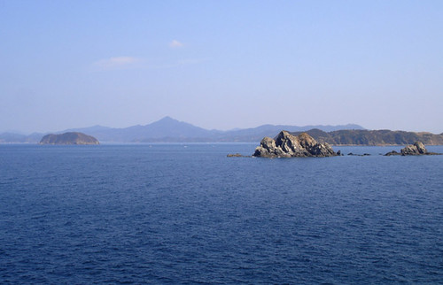 At Amakusa's southwest extremity are small islets, rocks and numerous shoals. They face the open sea and storm waves roll in during much of the summer and winter seasons Gongen-yama, the conical hill in the background on Shimo Island, is a landmark for local fishermen in the offing.
Things went smoothly the next 20km. It was easiest to just stare at the bow of the kayak, at the water just ahead, or at the speed readout of the GPS, and concentrate on form. Subtle changes in paddling stroke reflected clearly in the indicated speed. Hours slipped by, and my delay too was shrinking. Then, just before the landmark Ogase rocks, I suddenly saw some scum being sucked under deep by a small eddy in otherwise calm water. As soon as I went over this, my speed dropped by 15%. Oh great, the tide had changed! Looking ahead, the previously calm sea was now becoming crowded with small, dancing waves. The countercurrent became stronger and stronger, and soon I had to give up on making the 24-hour mark. After some moments of frustration, I resigned to my fate and paddled on. But this current took me by surprise; I didn’t know that such strong movement occurs here along the open seacoast. Clearly I don’t yet know enough about the Amakusa sea.
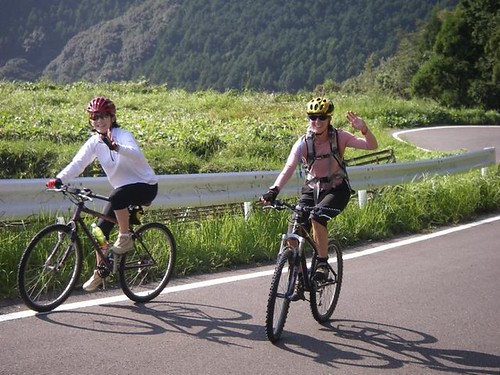
I made the goal 24h and 46min after my departure yesterday. Still in surprisingly good shape after such an ordeal, I didn’t feel sleepy or especially tired, though my back muscles were sore. Needless to say my legs didn’t work very well when I got out of the kayak; I had been sitting in the same position for more than a day! Therafter for another day, my butt would hurt just to sit on. Leanne had biked to Tomioka and had met me; presently we drove down the coast to the Shimoda hot spring, where I finally began losing consciousness in the hot bath. I hardly reacted as Leanne poured cold water over me to wake me up. I was flying high on endorphins.
Is a 24-hour circuit possible? By someone stronger than myself, certainly yes. For a while I wondered if doing it during the spring tide was a good idea; at neap tide one would only have to paddle steadily at 7.2km/h to make it. While the current may speed one’s progress, there seemed to be many times where I was also slowed down. At these times I was also obliged to deviate from my set course, adding further distance to the trip. But when I later subjected my trajectory to careful study, I found that although total course deviations added to 8km extra distance, the current still saved me 65 minutes overall. It was rather surprising that even though I tried to take only minimal breaks, my total de-powered time was 118 minutes! Clearly, breaks have to be better organized. Perhaps it’s possible to cut this time down by half. Finally, with the new, hard-earned hydrographic information, a few minor adjustments to the trajectory and timing could save another hour. Thus, at the same power output, maybe a 23-hour traverse is even possible, and by none other than scrawny Yours Truly. To be continued…