Not bad for Gumbies ガンビーズのくせに悪くない
Hi! In part, because we have a few more interesting pictures that we didn’t have time to put on the blog in ‘real time’, we’ll give it one more pass, including also some navigational data that might be of interest to people contemplating the trip in the future. So here goes.
旅の間インタネットがあった所で少しアップしましたが、それ以上色々な写真や話やナビゲーシオンのヒントをこれからアップするよていです。この旅をやってみたいと思う人に役に立つのかな?
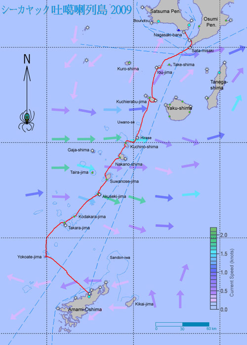
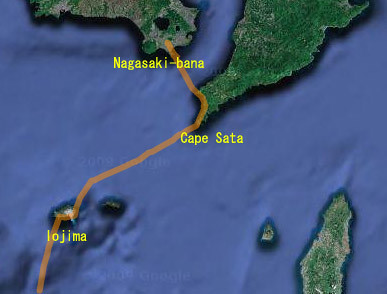
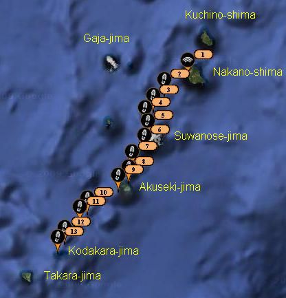
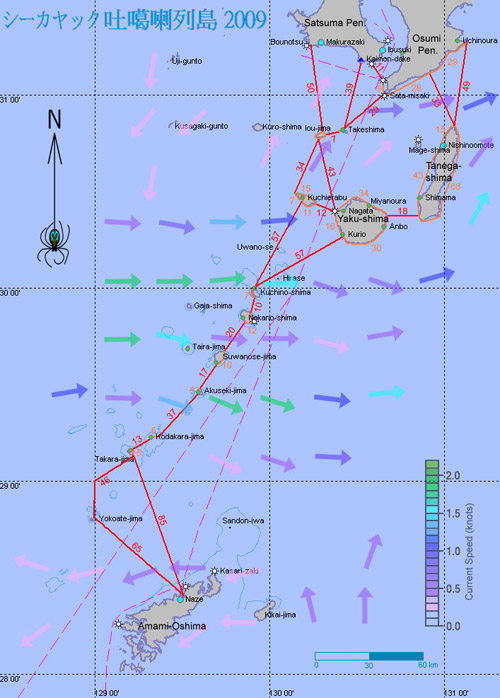
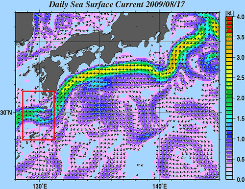
An map of the entire trip, also showing the predicted Kuroshio current. The prediction turned out to be accurate enough to help in strategy planning along the way. The trip was about 475km, done in 14 days including 3 days of waiting for better conditions. Without distractions on the open crossings, we averaged 6.3km/h, paddling and sailing.
旅の地図です。予想している黒潮の流れも載っている。14日間(三日間の休憩日も含めて)の遠征はおよそ475キロでした。平均スピードは6.3km/hでした。
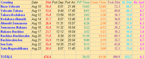
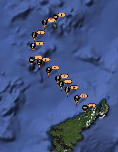
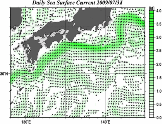
This is a chart of all the open sea traverses. The red numbers show the total distance paddled or sailed that day. Green numbers show the time taken port-to-port for each day. Orange is the time spent actually doing the crossing; purple is the crossing distance along track, whereas turquoise is the straight-line distance. Finally, average speeds for the crossings are in magenta; able to sail on about half the crossings, and having good luck with the currents, we were able to achieve some fairly good results.
これは横断の情報をまとめたチャートです。赤い番号はその日の距離。緑の番号は港から港までの横断時間です。オレンジの番号は横断の時間。紫の番号は横断の距離です。水色はまっすぐ横断したら、その距離です。ピンックの番号は平均スピードです。
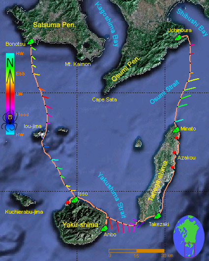
Day 1-2 (Amami-Oshima – Takarajima)
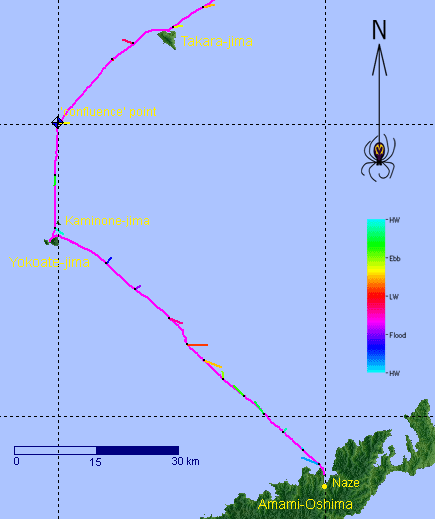
A map showing our movement, as well as the direction, speed, and (in color) the tidal phase of the sea currents encountered. On this section, currents were up to 1 knot in strength - normally not enough to seriously hinder a sea kayak's progress.
最初の二日間は蒸暑い環境に慣れようとしました。南西に位置していた台風のせいで3メータ以上のうねりがはいて、天気予報は変わりやすいの10-20ノットの南西の風でした。横当の無人島に到着できるかどうかのために緊張しながら出発しました。
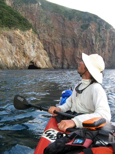
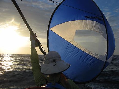
These two days were spent adjusting to our new environment. It was extremely hot and humid, and the sea was rolling with 3 meter waves coming from a typhoon far to the southwest. There were also south-west winds at 10-20 knots and the weather forecast was unsteady to boot. We therefore ventured onto the high seas with some trepidation. At least the currents here turned out relatively weak (up to 1 knot) and quite irregular, more or less as expected. On the way to Yokoate we encountered east-setting currents, which slowed us down a bit. We were able to make some of this up later by sailing (at a difficult angle to the wind), but not enough to prevent a nighttime landing. All along we had worries that the landing beach would be exposed to swells coming from yet another typhoon to our east, so we approached the island by starlight and with much anticipation; not relishing the thoughts of waiting in the kayak all night or paddling another 40km of nighttime swell to the next island. Luckily, we were able to land in small waves. The next day, windy and rolling conditions persisted on the sea while we sailed to Takara-jima on a good tailwind. On the way, for the record, we detoured slightly to a 'degree confluence point' - actually the point of exactly 29N latitude and 129E longitude. Strong currents were expected as we neared land, but they did not materialize and we approached in choppy but navigable seas. The incessant wind further intensified that night, a condition the locals said was not typical of the area’s summer weather.
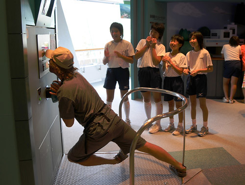
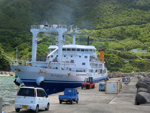
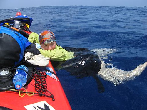
Killing time before boarding the ferry at Kagoshima, we visited a museum dedicated to erosion-control dams (yes, the Japanese have built a museum for just about anything you can think of), where I attempted to demonstrate my superhuman power to the enthusiastic cheering of four very excited schoolgirls on a summer vacation school trip. Sadly, I had generated only about 1/2250th of the force required to stop even a small mudslide. Crushing defeat or not, this measly impetus, coupled with Leanne's own paddle power, would have to do on our impending crossing of 400km of open sea and one of the world's post powerful ocean currents.
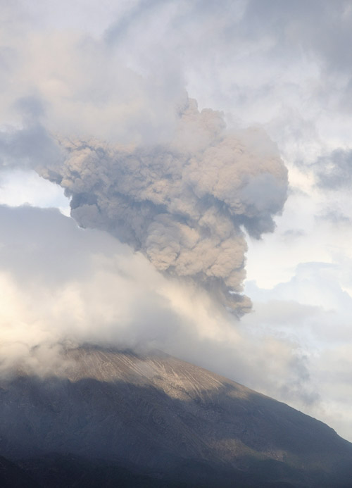
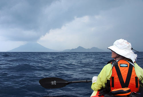
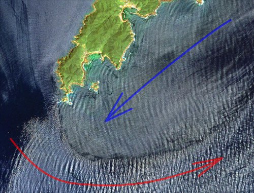
Another bad omen? Most of the islands we were about to visit had volcanoes, three of them active, and as the ferry pulled out of Kagoshima port, we were treated to an impressive eruption of ash from a fourth: the very nearby Sakurajima. But this couldn't have been very portentious: that day the mountain was burping almost continuously. Getting back to our parked car two weeks later, we found it covered by a layer of the fine greyish-brown dust so thick that our vehicle's original color could barely be made out. 丁度フェリーが出港すた時桜島は火山灰の噴火した。
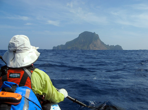
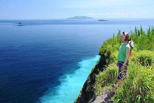
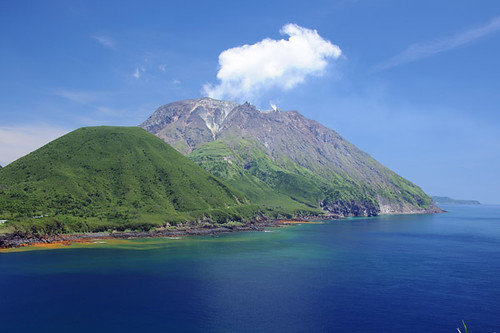
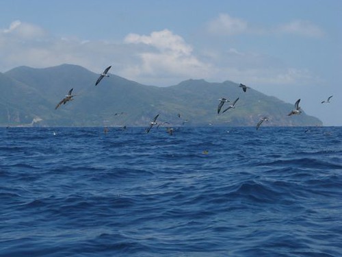
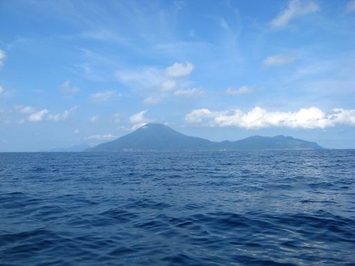
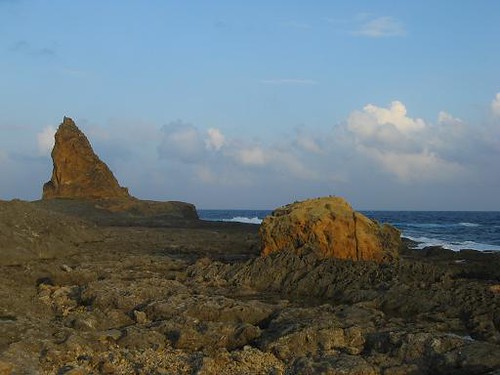
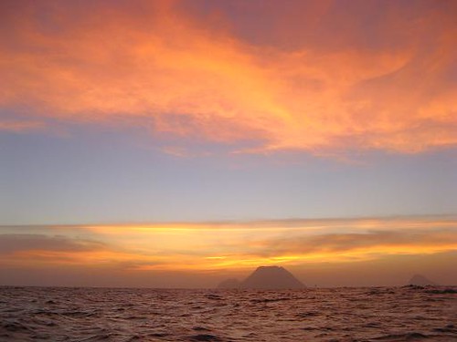
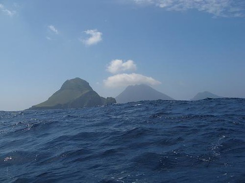
Day 2, morning. Kaminone-jima floats on the sea like a mirage. Overwhelmed by the raw intensity of it all for a good deal of this trip, we stared thoughtlessly at the world around us.
上ノ根島はミラージュのように水面の上に浮きます。
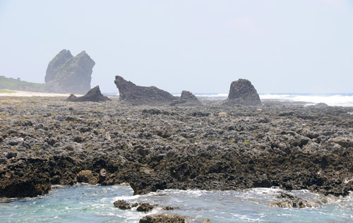
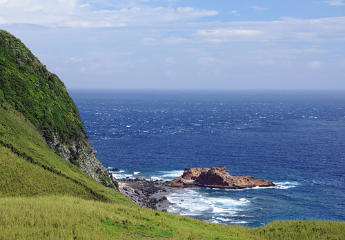
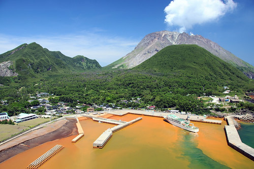
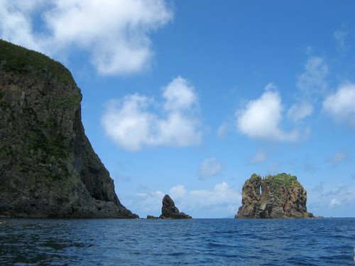
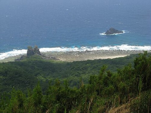
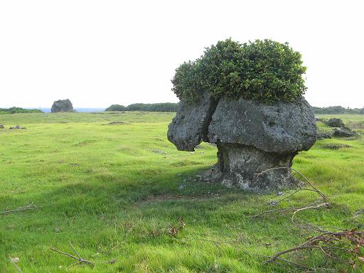
Bizarre rock formations on the reef shelf of Takarajima.
宝島の変わった岩の海岸。
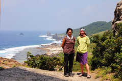
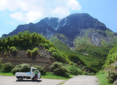
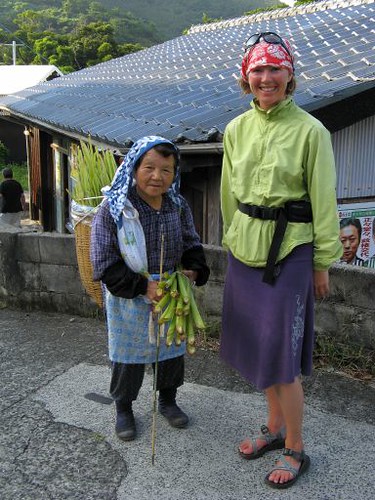
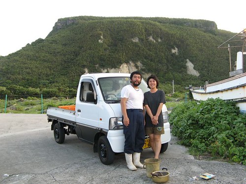
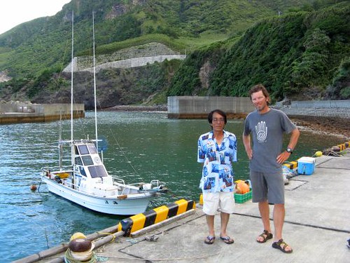
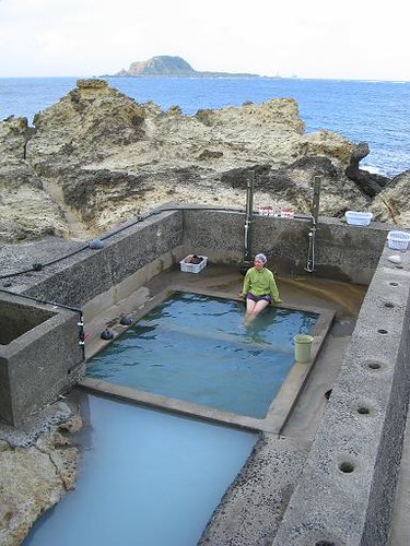
On Takarajima (Treasure Island) we ran into Makiguchi-san, a friendly resident who offered to take us on a tour in her truck.
宝島で優しい住民の牧口さんに会って、「島を案内しましょう」の招待を貰って、一緒にトラックで島を回りました。牧口さんの娘さんのYUKAチャンは宝島の暮らしやトカラ馬とのふれあいを日記にしています。
旅の間インタネットがあった所で少しアップしましたが、それ以上色々な写真や話やナビゲーシオンのヒントをこれからアップするよていです。この旅をやってみたいと思う人に役に立つのかな?
An map of the entire trip, also showing the predicted Kuroshio current. The prediction turned out to be accurate enough to help in strategy planning along the way. The trip was about 475km, done in 14 days including 3 days of waiting for better conditions. Without distractions on the open crossings, we averaged 6.3km/h, paddling and sailing.
旅の地図です。予想している黒潮の流れも載っている。14日間(三日間の休憩日も含めて)の遠征はおよそ475キロでした。平均スピードは6.3km/hでした。
This is a chart of all the open sea traverses. The red numbers show the total distance paddled or sailed that day. Green numbers show the time taken port-to-port for each day. Orange is the time spent actually doing the crossing; purple is the crossing distance along track, whereas turquoise is the straight-line distance. Finally, average speeds for the crossings are in magenta; able to sail on about half the crossings, and having good luck with the currents, we were able to achieve some fairly good results.
これは横断の情報をまとめたチャートです。赤い番号はその日の距離。緑の番号は港から港までの横断時間です。オレンジの番号は横断の時間。紫の番号は横断の距離です。水色はまっすぐ横断したら、その距離です。ピンックの番号は平均スピードです。
Day 1-2 (Amami-Oshima – Takarajima)
A map showing our movement, as well as the direction, speed, and (in color) the tidal phase of the sea currents encountered. On this section, currents were up to 1 knot in strength - normally not enough to seriously hinder a sea kayak's progress.
最初の二日間は蒸暑い環境に慣れようとしました。南西に位置していた台風のせいで3メータ以上のうねりがはいて、天気予報は変わりやすいの10-20ノットの南西の風でした。横当の無人島に到着できるかどうかのために緊張しながら出発しました。
These two days were spent adjusting to our new environment. It was extremely hot and humid, and the sea was rolling with 3 meter waves coming from a typhoon far to the southwest. There were also south-west winds at 10-20 knots and the weather forecast was unsteady to boot. We therefore ventured onto the high seas with some trepidation. At least the currents here turned out relatively weak (up to 1 knot) and quite irregular, more or less as expected. On the way to Yokoate we encountered east-setting currents, which slowed us down a bit. We were able to make some of this up later by sailing (at a difficult angle to the wind), but not enough to prevent a nighttime landing. All along we had worries that the landing beach would be exposed to swells coming from yet another typhoon to our east, so we approached the island by starlight and with much anticipation; not relishing the thoughts of waiting in the kayak all night or paddling another 40km of nighttime swell to the next island. Luckily, we were able to land in small waves. The next day, windy and rolling conditions persisted on the sea while we sailed to Takara-jima on a good tailwind. On the way, for the record, we detoured slightly to a 'degree confluence point' - actually the point of exactly 29N latitude and 129E longitude. Strong currents were expected as we neared land, but they did not materialize and we approached in choppy but navigable seas. The incessant wind further intensified that night, a condition the locals said was not typical of the area’s summer weather.
Killing time before boarding the ferry at Kagoshima, we visited a museum dedicated to erosion-control dams (yes, the Japanese have built a museum for just about anything you can think of), where I attempted to demonstrate my superhuman power to the enthusiastic cheering of four very excited schoolgirls on a summer vacation school trip. Sadly, I had generated only about 1/2250th of the force required to stop even a small mudslide. Crushing defeat or not, this measly impetus, coupled with Leanne's own paddle power, would have to do on our impending crossing of 400km of open sea and one of the world's post powerful ocean currents.
Another bad omen? Most of the islands we were about to visit had volcanoes, three of them active, and as the ferry pulled out of Kagoshima port, we were treated to an impressive eruption of ash from a fourth: the very nearby Sakurajima. But this couldn't have been very portentious: that day the mountain was burping almost continuously. Getting back to our parked car two weeks later, we found it covered by a layer of the fine greyish-brown dust so thick that our vehicle's original color could barely be made out. 丁度フェリーが出港すた時桜島は火山灰の噴火した。
Day 2, morning. Kaminone-jima floats on the sea like a mirage. Overwhelmed by the raw intensity of it all for a good deal of this trip, we stared thoughtlessly at the world around us.
上ノ根島はミラージュのように水面の上に浮きます。
Bizarre rock formations on the reef shelf of Takarajima.
宝島の変わった岩の海岸。
On Takarajima (Treasure Island) we ran into Makiguchi-san, a friendly resident who offered to take us on a tour in her truck.
宝島で優しい住民の牧口さんに会って、「島を案内しましょう」の招待を貰って、一緒にトラックで島を回りました。牧口さんの娘さんのYUKAチャンは宝島の暮らしやトカラ馬とのふれあいを日記にしています。
posted by Leanne and Rik Brezina at
10:10 pm
|
3 comments
![]()