Cape Sata ・佐多岬
Cape Sata is well known to the Japanese because it is the southernmost point of Kyushu and therefore of the entire Japanese 'mainland'. For this reason alone quite a few tourists make the long journey here. Sata is actually the end of the large, remote, and mountainous Osumi Peninsula, previously one of the most wayward domains of the Japanese Empire, and now a (still wayward) part of Kagoshima Prefecture. Due to its southern location (Cape Sata just punches through the 31st parallel of latitude) and the influence of the ever-warm waters of the Kuroshio current, the area is one of the few places in Kyushu that enjoys a truly subtropical climate. Plants typically to be found on the islands towards Okinawa can also be seen happily growing here. Relatively untouched by human interference, the wild coasts of the peninsula will impress any nature enthusiast willing to do a bit more than just drive the tourist road to the cape and back.
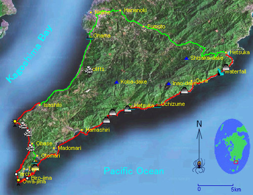
Cape Sata and environs, showing our kayak courses (red) and bike/walk courses (green). The short trip is 16km on the water, and 3km walking, and can be done easily in less than a day. The long trip is good for a weekend; 68km on the water and 46km by bicycle, with one monster hill. Both trips offer excellent scenery and great value per effort expended. Symbols on map show beaches, caves, rock gardens, and villages. 佐多岬の周辺の地図。シンボルは砂浜、ロックガーデン、洞窟、集落などを表す。
日本本土の最南端としてよく知られている佐多岬は、この理由だけで多くの人々は訪れる。佐多岬は、大隈半島と言う人工密度の非常に低くて山と大自然が広がる半島の端になる。岬の突端は、北緯31度にジャスト達しし、周りの海は黒潮の影響で暖かいから、他に南西諸島で見える亜熱帯植物が自生している。人工の手の被害も少なく、探検好きなネイチャーの愛好者の天国です。
At Kagoshima Port ・ 鹿児島港にて。
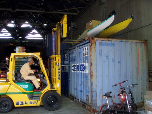
Sata is a bit far from Amakusa, so we've only been there twice so far. This time around, a convenient chance to go offered itself because we had to pick up our kayaks at Kagoshima port. The kayaks and gear were delivered by ship from the Yaeyama Islands of Okinawa, where we spent our spring vacation.
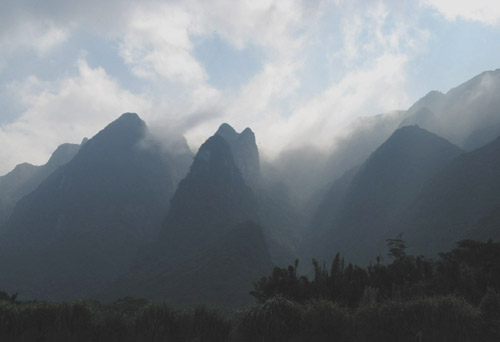
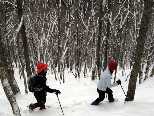
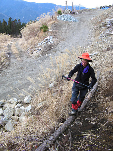
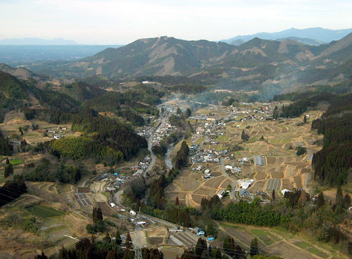
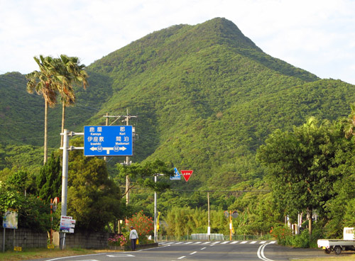
Steep mountains and cliffs along the bicycle route. 自転車から見た大隈の険しい山々。
天草よりちょっと遠いだけど、先週末八重山から鹿児島まで届けたカヤックを取りに行ったので、佐多岬を訪れる機会になった。これは、私たちの二回目の訪れ。一回目は、自転車を使ってもうちょっと長い二日間の旅をした(カヤック、岩の海岸の屈曲を含めて68kmで、自転車の坂のかなりあった46kmのコース)。今回は、日帰りで16kmのコースで岬の突端だけを回って、3kmの道路沿いやさしい歩きで車まで戻った。どちらでも一流のツアーになります。
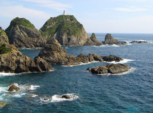
The scenic beauty of the coast culminates in the complex cliffs, rocks, islets, and reefs of the cape itself. Here, the East China Sea meets the Pacific Ocean. A lighthouse marks this navigationally crucial point of land. 美しい佐多岬の複雑な地形。大輪島と言う岬自体の南にある小島に、灯台がある。
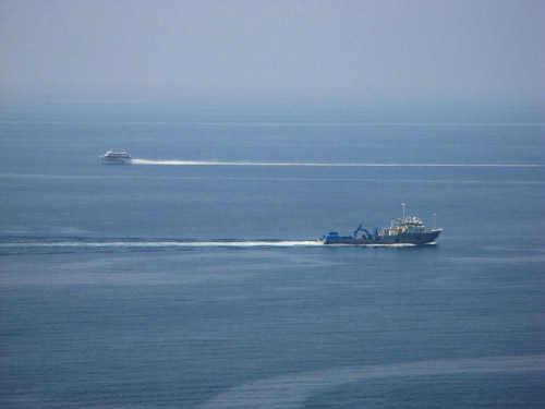
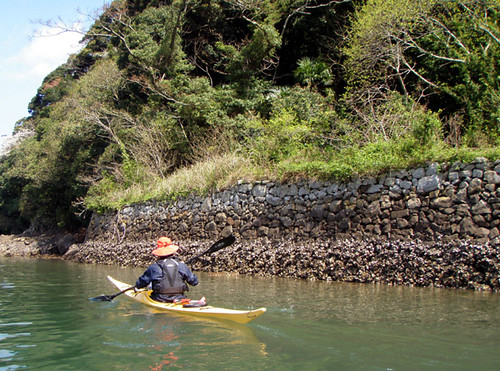
The cape stands at the entrance of Kagoshima Bay at the head of which is Kagoshima City, the largest population center and most important port of the south half of Kyushu. The mouth of the bay is always busy with shipping traffic; virtually all passengers and cargo vessels to and from the Nansei Islands pass through here. 鹿児島湾口を入ったり出てりする船舶。南西諸島の各島と本土を結ぶ便はほとんど皆ここを通る。
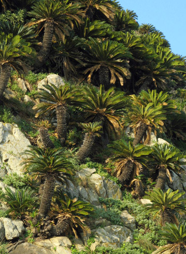
Cycad palms grow in abundance on the steep slopes of the cape. Nearby Biro-jima island is covered in fan palm trees. Both are subtropical species and cannot be found growing wild north of here. 岬の急海岸にソテルが茂っている。近くの枇榔島はビロウのやしの木に覆われている。本当に亜熱帯だ。
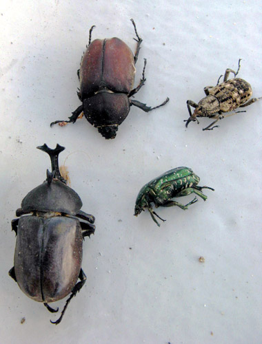
A collection of large dead beetles under the Cape Sata Lighthouse. The bright beam attracts these nocturnal fliers here from afar, to an untimely death by light addiction. 佐多岬灯台の土台で、死んだ甲虫のコレクション。

Leanne weaves her way through the cape's rock gardens. 里杏は岬のロックガーデンを通る。
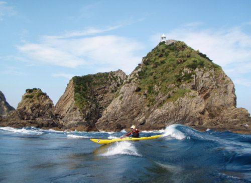
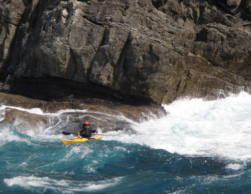
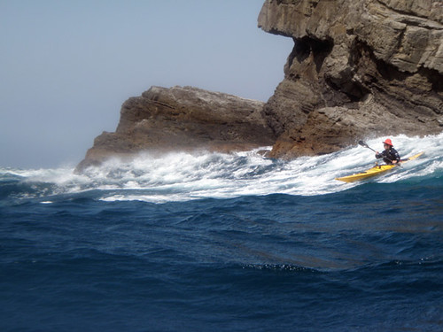
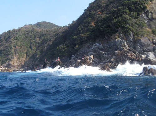
Where two oceans meet, strong currents usually flow, and Sata is no exception. We spent a half-hour playing in the rough water off the tip of the southernmost rock. The water moved with the speed of a swift river, and it was just possible to surf the waves generated by rocks below. 二つの海がつないでいる場所では、普段に海流がある。佐多岬もそうだ。ここで、最南端の岩の沖、東シナ海から太平洋へ強い流れがあって、30分ほど遊んだ。
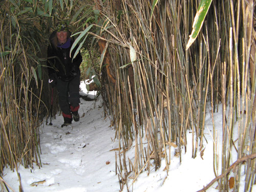
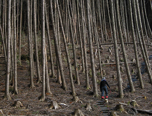
Enjoyable scenery along the walk back to our car. 車までの歩き途中。素晴らしい名前も無い山が後ろにそびえている。新夏の緑の中で、ハイビスカスなどが咲いていた。楽しい散歩でした。
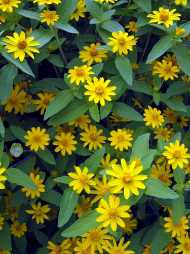
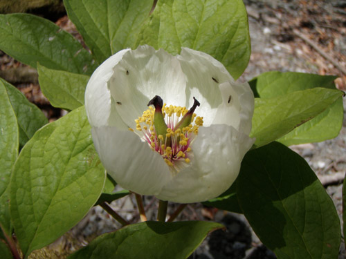
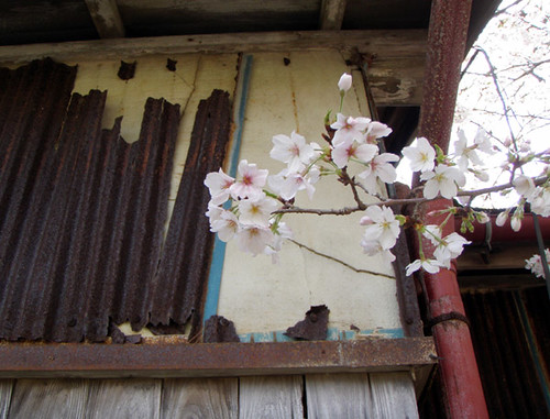
Flowers in a small village along the Osumi coast. 小さな集落の花畑にて。
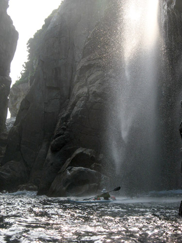
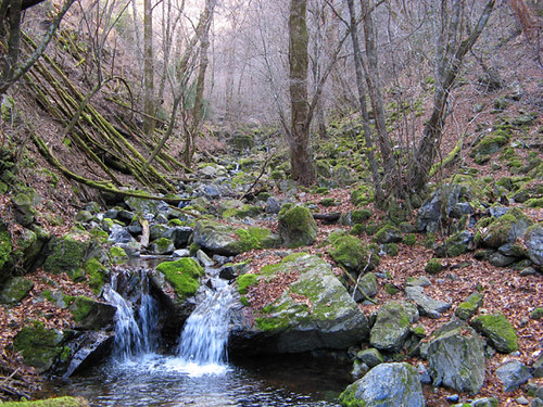
This vigorous 25m waterfall is one of the highlights of the long circuit. Passing through in the heat of the summer washes off sweat, salt and fatigue. 海に直接落ちているこの25メートルの滝は、二日間の旅のハイライトの一つだった。冷たい水で夏の暑さをいやした。
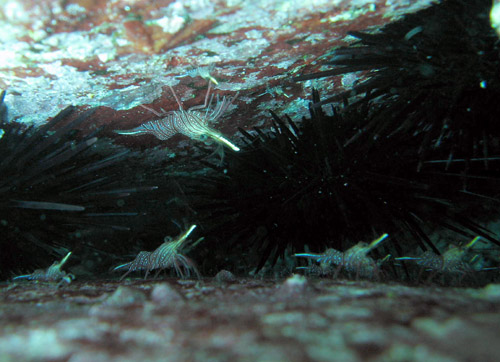
Snorkeling along the Osumi coast one sees the typical inhabitants of a subtropical rocky seascape. Here, rock shrimp sit motionless amid sea urchins in a dark crack of an undersea boulder. 海が落ちづいているなら、素潜りも楽しい。典型的な岩の海岸の生き物たちが見える。
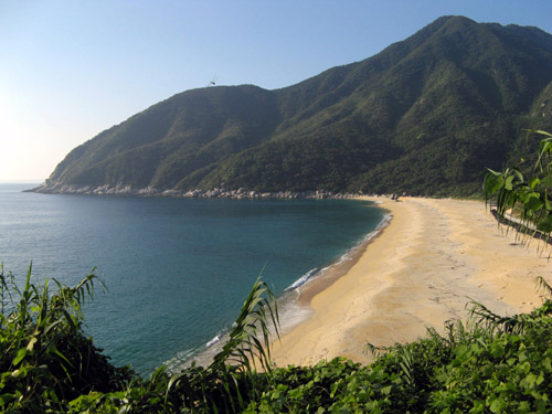
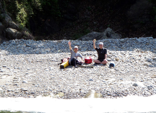
Wow! This kind of wild, beautiful beach can't be found in too many places on mainland Japan anymore. It's a bit too far from civilization, so no tetrapods or concrete here. The full fury of Pacific storms is nevertheless held in check by a massive bar of clean, granitic sand. The two-day tour ends here at the village of Hetsuka which is so tiny as to be entirely lost in the thick foliage just inland of the beach. こんな素晴らしい、自然の砂浜もう日本では珍しいものになっているでしょう。テトラポッドやコンクリートも全くない。 それなのに、砂が台風の太平洋にも耐える。ここ辺塚と言う小さな集落もあるけど、茂っている木に完全に覆われている。二日間の旅の終点はここでした。
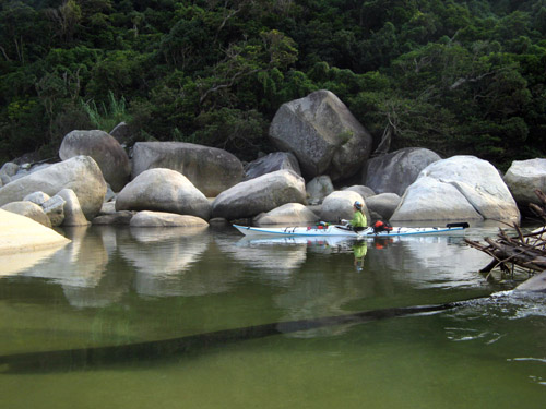
Leanne enters the quiet estuary of a clear river - a sudden change of atmosphere from the noise and waves of the Pacific. 清水の川に入った里杏。太平洋の波を後ろに残して、突然の静かな景色。
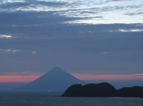
At dusk, the Fuji-like Mt. Kaimon dominates the opposite shore of Kagoshima Bay. 明け方、鹿児島湾の向こう側に「薩摩富士」の開門岳が見える。
Cape Sata and environs, showing our kayak courses (red) and bike/walk courses (green). The short trip is 16km on the water, and 3km walking, and can be done easily in less than a day. The long trip is good for a weekend; 68km on the water and 46km by bicycle, with one monster hill. Both trips offer excellent scenery and great value per effort expended. Symbols on map show beaches, caves, rock gardens, and villages. 佐多岬の周辺の地図。シンボルは砂浜、ロックガーデン、洞窟、集落などを表す。
日本本土の最南端としてよく知られている佐多岬は、この理由だけで多くの人々は訪れる。佐多岬は、大隈半島と言う人工密度の非常に低くて山と大自然が広がる半島の端になる。岬の突端は、北緯31度にジャスト達しし、周りの海は黒潮の影響で暖かいから、他に南西諸島で見える亜熱帯植物が自生している。人工の手の被害も少なく、探検好きなネイチャーの愛好者の天国です。
At Kagoshima Port ・ 鹿児島港にて。
Sata is a bit far from Amakusa, so we've only been there twice so far. This time around, a convenient chance to go offered itself because we had to pick up our kayaks at Kagoshima port. The kayaks and gear were delivered by ship from the Yaeyama Islands of Okinawa, where we spent our spring vacation.
Steep mountains and cliffs along the bicycle route. 自転車から見た大隈の険しい山々。
天草よりちょっと遠いだけど、先週末八重山から鹿児島まで届けたカヤックを取りに行ったので、佐多岬を訪れる機会になった。これは、私たちの二回目の訪れ。一回目は、自転車を使ってもうちょっと長い二日間の旅をした(カヤック、岩の海岸の屈曲を含めて68kmで、自転車の坂のかなりあった46kmのコース)。今回は、日帰りで16kmのコースで岬の突端だけを回って、3kmの道路沿いやさしい歩きで車まで戻った。どちらでも一流のツアーになります。
The scenic beauty of the coast culminates in the complex cliffs, rocks, islets, and reefs of the cape itself. Here, the East China Sea meets the Pacific Ocean. A lighthouse marks this navigationally crucial point of land. 美しい佐多岬の複雑な地形。大輪島と言う岬自体の南にある小島に、灯台がある。
The cape stands at the entrance of Kagoshima Bay at the head of which is Kagoshima City, the largest population center and most important port of the south half of Kyushu. The mouth of the bay is always busy with shipping traffic; virtually all passengers and cargo vessels to and from the Nansei Islands pass through here. 鹿児島湾口を入ったり出てりする船舶。南西諸島の各島と本土を結ぶ便はほとんど皆ここを通る。
Cycad palms grow in abundance on the steep slopes of the cape. Nearby Biro-jima island is covered in fan palm trees. Both are subtropical species and cannot be found growing wild north of here. 岬の急海岸にソテルが茂っている。近くの枇榔島はビロウのやしの木に覆われている。本当に亜熱帯だ。
A collection of large dead beetles under the Cape Sata Lighthouse. The bright beam attracts these nocturnal fliers here from afar, to an untimely death by light addiction. 佐多岬灯台の土台で、死んだ甲虫のコレクション。
Leanne weaves her way through the cape's rock gardens. 里杏は岬のロックガーデンを通る。
Where two oceans meet, strong currents usually flow, and Sata is no exception. We spent a half-hour playing in the rough water off the tip of the southernmost rock. The water moved with the speed of a swift river, and it was just possible to surf the waves generated by rocks below. 二つの海がつないでいる場所では、普段に海流がある。佐多岬もそうだ。ここで、最南端の岩の沖、東シナ海から太平洋へ強い流れがあって、30分ほど遊んだ。
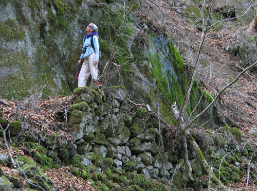
Enjoyable scenery along the walk back to our car. 車までの歩き途中。素晴らしい名前も無い山が後ろにそびえている。新夏の緑の中で、ハイビスカスなどが咲いていた。楽しい散歩でした。
Flowers in a small village along the Osumi coast. 小さな集落の花畑にて。
This vigorous 25m waterfall is one of the highlights of the long circuit. Passing through in the heat of the summer washes off sweat, salt and fatigue. 海に直接落ちているこの25メートルの滝は、二日間の旅のハイライトの一つだった。冷たい水で夏の暑さをいやした。
Snorkeling along the Osumi coast one sees the typical inhabitants of a subtropical rocky seascape. Here, rock shrimp sit motionless amid sea urchins in a dark crack of an undersea boulder. 海が落ちづいているなら、素潜りも楽しい。典型的な岩の海岸の生き物たちが見える。
Wow! This kind of wild, beautiful beach can't be found in too many places on mainland Japan anymore. It's a bit too far from civilization, so no tetrapods or concrete here. The full fury of Pacific storms is nevertheless held in check by a massive bar of clean, granitic sand. The two-day tour ends here at the village of Hetsuka which is so tiny as to be entirely lost in the thick foliage just inland of the beach. こんな素晴らしい、自然の砂浜もう日本では珍しいものになっているでしょう。テトラポッドやコンクリートも全くない。 それなのに、砂が台風の太平洋にも耐える。ここ辺塚と言う小さな集落もあるけど、茂っている木に完全に覆われている。二日間の旅の終点はここでした。
Leanne enters the quiet estuary of a clear river - a sudden change of atmosphere from the noise and waves of the Pacific. 清水の川に入った里杏。太平洋の波を後ろに残して、突然の静かな景色。
At dusk, the Fuji-like Mt. Kaimon dominates the opposite shore of Kagoshima Bay. 明け方、鹿児島湾の向こう側に「薩摩富士」の開門岳が見える。
Labels: kayak expedition シーカヤック遠征
posted by Leanne and Rik Brezina at
9:17 pm
|
0 comments
![]()