Gumbies

Friday, September 29, 2006

Okinawa Kayak trip, Summer 2006, Part 5

izena-appch
Soon we were past the Captain’s fishing grounds at the eastern point of Ie-jima, heading for the distant hills of the Izena-Iheya archipelago. This odd group of islands had aroused curiosity in us. Izena, the southern of the two larger islands, is round and relatively flat, except for several steep conical hills scattered here and there. Iheya, on the other hand, is long and narrow, with a dinosaur spine of tall mountains along its axis. Between the mountains are steep gaps that drop nearly to the sea, so that from the east or west, the island must appear as a line of mountainous islets. From our angle, it looked as one tall mountain only. This time, luck smiled on us and we were picked up by a helpful current only a few kilometers out from Ie-jima; this helped us until sunset when the sea calmed completely. It was very dark as we approached the reefs but the narrow channel was clearly marked on our GPS map and we soon picked out its marking light in the night scenery. We then headed to a tiny port where we easily found the boat ramp. Just beside was a fresh lawn and a great place to camp. Content with our relatively quick 8½ hour traverse, we had energy left over and after unpacking, we took a leisurely midnight stroll through the sleeping town with its stone and concrete walls and low houses, squat against the force of the typhoons. Finally we settled into our tent for a comfortable, restful sleep.

We put in leisurely and not too early the next morning. For two days a strong northwest wind would be blowing: a side effect of yet another typhoon passing safely to the north of us. We would not venture on the open sea today or tomorrow, and conveniently shielded from the worst of the wind and waves by the islands, we would therefore enjoy two leisurely days paddling to cape Dana, the northernmost point of Iheya.
diving
Seeing a nice beach soon after we set off, we thought, why not do some snorkeling here too.
namako
A horny sea cucumber.

tombs
Continuing on our way after a refreshing swim we take time to look at some ancient tombs. These tombs made in the image of a mother’s womb are large sturdy structures, which hold remains of an entire family.
nentouhiramatsu1
nentouhiramatsu2
The ancient Nentou Hiramatsu, a giant umbrella shaped Ryukyuan pine tree provides an ideal place for a nap.
izenajou
Izena Island is also famous as the birthplace of King Sho En, the founder of the Second Sho Dynasty in the Ryukyu islands which lasted until 1879, when the Japanese government brought the Ryukyu kingdom to an end and announced the establishment of Okinawa prefecture. Ruins of a castle from the 14th century can be seen at the base of this mountain.
yanaha2
gusukuzaki
Jagged rock outcroppings and crystal clear turquoise water.

kubayama1
kubayama2kubayama4
The northwestern winds continue to rage, but we rarely notice as we move leisurely up the eastern coast of Izena. By noon of the second day we have made it to the cape. We can’t move any further in this weather. In order to check out the sea conditions we climb up the road to the top of Mt. Kuba where there is a lighthouse. This mountain is famous for its palm trees, which are called Kuba trees in the local dialect.
kumaya
Deciding that conditions would be manageable for the traverse in the morning, we set out exploring the Kumaya cave found near the cape.

Wednesday, September 27, 2006

Fall Equinox

higanban
These beautiful red flowers popping up everywhere mirror the happiness many of us feel with the coming of fall. Finally, living has once again become cooler and more comfortable!

Thursday, September 21, 2006

Okinawa Kayak trip, Summer 2006, Part4

aguni3
Okinawa Kayak trip map.
On our way from Kume Island to Aguni island we almost right away met the expected westerly current that was to slow us for the first 10km or so. Fighting the current directly is wasteful, so we set a more northerly course than required and let ourselves drift, hopefully making up for our lost direction with our increased speed. Nevertheless an early loss of morale descended on us due to the slow progress; this combined with a calm sea and a bright, hot early morning sun to induce in me an immense sleepiness. In a kayak it’s similar to (though definitely less dangerous than) driving a car when you’re sleepy: you flounder into semi-consciousness, to be snapped into action with a start – this time it’s a only quick brace to avoid plopping face-first into the water. It got so bad that soon I had no choice but to “pull over”, trying to nap while crammed most uncomfortably into the kayak. Twenty minutes later, I had already drifted a kilometer westward and Leanne was just a tiny speck on the horizon. An hour later when I caught up to her, I was sleepy again! I announced a revised course, and seeing Leanne follow it faithfully I dozed off again. Later the current had gradually veered and weakened, allowing us to compensate more favorably, and for a while things went quickly. Then within what we thought would be an hour west of Aguni’s prominent Cape Fudan, a new counter-current began. It was difficult to say whether this was due to the change in the tide, or a phenomenon caused by the island itself; in any case it cut our speed in half. We fought on valiantly as the cliffy cape grew ever so slowly before us. Over two hours later, we were finally past it in stationary water. It took another 45 minutes to go to the port, 3km distant (we were tired!). Leanne looked overheated so we hosed ourselves down repeatedly, drank cold Cokes and can coffees from the jidohanbaiki and sat in the breeze while our temperatures returned to normal, at first almost shivering though it was 35C.

Next day the heralded northerly breeze began. We considered our tired condition, the headwind and the fickle, unpredictable currents. To do the 55km traverse to Ie-jima, the longest of our trip, would be imprudent today. So we recuperated and wandered about, talking with the friendly locals and numerous holiday divers from Japan’s large cities. Due to the clarity of its sea and its isolated position, Aguni is one of Japan’s most famous diving destinations, where one can swim about among schools of tuna and other large fish. The divers, like most holidaymaking Japanese, have very limited time (say, 3 days) to enjoy their vacations so they do not mind paying something like $100 per dive, definitely enriching the local economy. Ironically, our time and energy were even more limited and for the sake of rest we did not paddle to the cape and snorkel among the tuna (for free).
aguni-dinner
However we did hook up with some visiting snorkelers for a shell hunt around the reef just outside the harbor. With their cooperation and crowbar, I was able to wrench a huge clam from the deeper part of the reef and our floating basket quickly filled with other clams and fist-size snails. All this was devoured with dinner at the snorkelers’ inn, mostly in the raw state, as locals prefer. The giant clam had an unexpected taste, not at all unpleasant, but I felt a bit unworthy eating it as a delicacy and not having left it in the reef where it had been growing for so many years.

Returning to the port at night, we saw the divers engaged in a lively drinking party at the picnic tables. We said good-by as we would be leaving for Ie-jima before dawn.

By this point we had given up predicting the currents; the information gleaned from the Japan Coast Guard website seemed all wrong and though I’d made careful measurements every few kilometers on all crossings (utilizing the GPS and a Coke bottle filled with seawater), this information remained too scant to extrapolate from. On the west side of tiny Aguni Island the current is least at low tide, so we selected our departure thusly. Yet on the island’s east side, where we now found ourselves, the current was still full strength. Another epic traverse had begun. We made truly pathetic progress until about noon; we tried not to keep glancing back to see how close Aguni still appeared. Then the current vanished, and we made good headway into the late afternoon. Though no land had been visible most of the time, the hitherto unusual sight of bits of garbage in the water told us we that were approaching the populated coast of Okinawa. Ie-jima, quite flat except for a single, landmark, pimple-like mountain (locally called Tatchuu) had become visible when 20km distant; at about the same time a weak current once more set against us. The sun had sunk quickly into the sea and now the lights of Ie-jima belied the scale of the seascape. It seemed to take a long time as the waves, wind and current slowly diminished in the island’s shadow; at 11pm we were finally between the lights marking either side of the artificial opening in the reef and the entrance to a fishing port. It had taken us 19 hours to paddle here from Aguni; due to the currents we were obliged to lengthen the 55km direct course to a more sinuous 61km. Obviously exhausted, we were lured now more by sleep than by hunger. But we struggled to stay awake a little more to cook and devour a quick pasta dinner. Without food we might wake up useless the next morning, but we could not afford another rest day at this point.

The sun woke us up with its heat not long after it rose. The port, however, had a large roofed area with – sofas! As we relished in the decadent comfort of these household rejects, we realized it had been a really long time since our previous sofa experience – in Japan one usually sits on the ground, more or less. Certainly a number of families on Ie-jima were bucking tradition. Waiting out the noonday heat we lounged on, planning to set out in the afternoon for Izena, 34km to the northeast. In the meanwhile we were noticed by the locals: first an elderly gentleman who, unprompted, raced off in his mini-truck, returning with what he thought island-hopping foreigners might enjoy eating: convenience store cheese-burgers, fried chicken, sandwiches, a frozen 2 liter bottle of “Pocari Sweat” (imitation Gatorade), and just in case, two Japanese ‘bento’ box lunches. He figured we’d be hungry, and hungry we were.
kakkui-om
The good will of friendly island folk like this gentleman who brought us a three-course convenience store lunch, cannot be denied.

Later, very stuffed, we napped contentedly on the sofas, but soon a motley group of fishermen invited us to their corner, all sharing a lunch consisting of chunks of raw fish and clams mixed wholesale with soy sauce in a ripped-open plastic water bottle. Conversation was lively and animated and one particular character, referred to by everyone as ‘sencho’ (the Captain) commanded a lot of respect and attention. He had just returned from spearing fish with an abundant catch of choice species, his full-body wetsuit now unzipped dangerously low under his protruding naked belly. He showed not a smidgeon of embarrassment when a group of obviously influential local ladies suddenly showed up to spread some civic message, and displayed only a mild satisfaction when one of them bought the choice of his catch on the spot for a very reasonable day’s wages. When we told him about our travels, he said to us, “Antatachi wa purimun da”, using a dialect word that, loosely translated, spans the spectrum of somewhere between ‘stupid’ and ‘idiot’. “I tell you this, because when you’re ‘purimun’, you won’t notice it yourself”, he added helpfully, as the others chuckled. When Leanne pointed to the air compressor on his boat and said that he might be the purimun, diving to 40 meters with an air hose in his mouth, he retorted, “Yeah, but I have a kid in university I have to pay for. You do this nonsense on your free time!” Talking with the Captain was a blast and too soon, it was time to go. Everyone waved enthusiastically as we paddled out around the port breakwater.
local-boyz
The Captain lights up after a hearty lunch of raw fish, soy sauce, and Okinawa’s own Orion beer.

Tuesday, September 19, 2006

Part 3 Okinawa Kayak trip, Summer 2006

Map of the kayak trip.
We had planned to circumnavigate Kume-jima, which promises to be an interesting island: besides Okinawa, where we touched down so briefly, it is the biggest we would visit, and the most westerly. Off its west cape the warm Kuroshio Current -- the Pacific’s Gulf Stream -- flows through the deep open sea that forms the biggest break in the Ryukyu island chain between Kyushu and Taiwan: Miyako-jima, the next island, lies 220km away. Besides, the island has interesting reefs and topography including fresh-water springs in its seaside cliffs. On this trip with so many open crossings we had been looking forward to following a coast for a while. But we cannot afford the extra day the circumnavigation would take on account of the weather forecast, so we content ourselves with a minimal visit to the town of Madomari.
oosotetsu
A lean and well-muscled fisherman is busy cleaning his net with a high-pressure hose at the port as we pull the kayaks up the boat ramp. When he hears where we came from, his surprise throws him in such a good mood that he gives us a lift to the local supermarket in his mini-truck. We buy breakfast and wander over to the nearby “giant sotetsu palm tree” marked in our map. This is actually in a private, meticulously preened garden around an old house, and being there we are once again taken in by the inescapable beauty and balance that always resides around a traditional Japanese dwelling. We talk with an elderly woman who had been gardening in the relative cool of the morning, then admire the tree. Sotetsu don’t grow very tall, so this one has spread itself horizontally in a wonderful, semi-chaotic tangle of its characteristic thick, spiny branches. Out of the shady nooks, several different kinds of ferns grow. The tree has created its own microclimate, and we forget how hot the morning is becoming until we step out of its shade.
bridge
An artificial channel has been blasted through the eastern reef saving small vessels a 25km detour over frequently rough seas. Over this, a concrete bridge has been built, presumably for shell gatherers since much of the reef dries at low tide. Now at high water, the bridge looks strange, as if floating in the sea.
tatami-ishi
Kume-jima’s most touted tourist attraction is the so-called tatami (mat) rocks. Somehow the sea has effected a neat cross-section of a group of polygonal volcanic basalt columns; these make a curious sight against the pleasing backdrop of distant reefs and shallow lagoons with turquoise water. For good measure, additional attractions have been tagged on nearby, including a sea-turtle museum where turtles of several species can be seen swimming about in tanks. By now it is oppressively hot outside and we seek the museum for its air-conditioning as much as anything else. We hang out inside for a couple of hours. When we come out, it is very hot and we promptly feel the need to escape into the adjoining restaurant for a rather good gurukun grilled fish lunch and very overpriced shaved ice which did not compare in quality or quantity to the mini-truck restaurant’s at Tonaki.
hatenohama
Finally, tourist traps exhausted, there was nothing else to do but to move on. It was getting late anyway, just enough time to make it back to the Ogan-saki lighthouse that we had passed in the wee hours of the morning. From there, we would strike out for Aguni-jima, the next island, 40km to the northeast. For 10km we navigate the twisting shallows and sandbanks in the interior of the huge reef; we had never seen such a place before. On the north side, the edge of the reef is above the water at low tide, a delicate but unbroken line stretching in a wide arc until it sinks below the horizon, giving the illusion of the lagoon opening to the sea. On the south side, the reef is broken and very complex, with many bays fringed by shoals, and occasional channels opening to the sea. It would be a delight to completely explore this complex, delicate landscape. Long sand spits had built up on top of some of the shoals; at low water, they are kilometers long but probably only a small portion remains dry at high tide. The sun is angling low in the sky when we land on the tip of the very last spit to survey the lighthouse, still 3km away, for camping possibilities. The binoculars reveal a concrete pedestal large enough to put the boats on in case the surrounding rocks go under water. Certainly we could not camp here on the spit: it still had wave marks from the previous high tide and the water is now rising rapidly.
ogan
The lighthouse pedestal turns out to be a tad low but big enough, and there is even a helipad, only five feet above mean sea level (this is painted on it in large letters). It is of course big and flat, but perhaps not too prudent to camp on, the Japanese Constitution notwithstanding. There seems to be a distinct lack of high ground, besides the lighthouse. Furthermore, we are still inside the reef, and the lighthouse cannot be climbed to get a view of any breaks. So, amid a spectacular sunset, I paddle off in a hurry to check out a break about 2km away that we had seen on a satellite image. Big waves are breaking on either side but the break itself is deep and plenty wide to use as an exit. Carefully I mark it in the GPS, and hasten back in the gathering darkness. By nightfall the sea has obliterated all land except the helicopter pad, the lighthouse base, and the concrete walkway between them. By 9:30, the walkway is under water too. We are floating on a tiny, lonely, artificial island in the middle of the ocean, the nearest solid land many kilometers away. There are only the sounds and the smells of the sea, and the Milky Way shining brilliantly above. Schools of fish have invaded the briefly flooded land looking for forage, jumping crazily over the shallow rocks. We are there, so delicately safe, water now spilling over the low parts of the platform. All this is ours for a precious couple of hours. At 10pm, the water begins receding, and we grab a few hours of sleep. By 4am, we are navigating the break by GPS, dim outlines of waves crashing down around us in the darkness. Once free of the reef, we turn northeast toward Aguni, whose powerful, elevated light can already be seen above the waves.
kumejima

Sunday, September 17, 2006

Typhoon

akashima
tsurubayama
Typhoon number 13 passed through Amakusa this Sunday afternoon. Winds of 151km/h were recorded in Ushibuka city at about the time we took these pictures.

Thursday, September 14, 2006

Okinawa Kayak trip, Summer 2006, Part2

tonaki-s
The next day is windy and waves are breaking on the reefs, but the typhoon has moved off fast and things are only going to get better, so there is no reason to stick around. Although all ferries and flights in the area have been cancelled, we make fairly quick work of traversing the 20km or so northwest to Tonaki Island. A wild, cliffy coast greets us and running the reef on the way to port we disturb the slumber of no fewer than six enormous sea turtles.
tonaki-view
Tonaki is quite small and has mountains in the north and south, while a saddle shaped depression in the middle is home to its only village and a few sandy fields. This wind-tunnel topography makes typhoons doubly formidable here: all flat land is exposed. From a hilltop viewpoint the town seems so isolated and desolate, so utterly surrounded by the vast sea. But the folks that live here know how to tough it out and today, the day after a typhoon, everyone is lively.
tonaki-street
Over time stone walls and live walls of dense trees have been established so that the whole village is enveloped in their quiet shadows and it is a pleasure to walk through on a hot summer day.
turtle3
It is only a short walk from the port to the sea on the other side of the island, where the reef looks most inviting for diving, so we grab our snorkel gear. We have to swim out almost a kilometer before we reach the reef’s edge, but are rewarded with sights of many fish, sea turtles, and even a shark.
shark2
We want to see more, but are driven back by an isolated thundershower. Walking back in the warm rain, we spy the town office. Our cell phone won’t work here, so we go in to ask if we can use their Internet to check the weather. Inside we behold a bizarre sight: at least a dozen people shuffling papers, sitting behind computers, stacks and stacks of papers everywhere – is this really what it takes to administer a village of a couple hundred people? Many computer screens flicker familiar Internet images, but of course our humble request to use one of them for a couple of minutes is flabbergasting. Eventually we get our way. Still dripping wet from the sea and rain, we begin to freeze in the over-air-conditioned space, and are relieved to exit back into the damp heat, a printout of a fresh weather forecast in hand.
tonaki-sisi
Guardian lion dogs known as shiisaa decorate the roofs of most houses

Only two tiny, under-stocked stores are to be found on the island. Where do people get their food? We seek dinner at the only “restaurant”, that is, a sign in front of a permanently parked mini-truck that now seems to serve as a home proclaims that one can eat food here. The occupant, a middle-aged woman, seems quite surprised to see us, but serves us a simple, delicious meal. We’re in no hurry and she’s quite eager to talk, so we also order shaved ice with strawberry syrup and sweetened condensed milk. Originally from Osaka, she had moved here many years ago with her father, and when a typhoon promptly destroyed their home, she never found enough money to build a new one. Now she ekes out a living growing millet, patiently waiting till she’s old enough to go on government pension. She tells us about other kayakers who ate here last year; they had a similar itinerary and were evidently her last customers before we showed up! So she was quite surprised, so sorry. Definitely not enough tourists here to make a living running a restaurant, though people try from time to time, she said. I wonder to myself: why are people who live in these kinds of places so candid? Normal Japanese are so painfully plagued with a certain sense of shame and embarrassment; this makes interesting casual conversation just about impossible. Certainly they wouldn’t share such honest life stories with strangers.
irisuna
Loitering about town, we end up at the ferry terminal where we discover a startling fact: Tonaki’s satellite island, Irisuna-jima, which seemed up to now an ideal camping spot, is actually a shooting range for the Japanese military. Had it not been for the accidental sign showing an unusually accurate chart of the ferry’s route (which carefully skirts said area), and our equally accidental visit to this deserted-looking building, we may well have soon been on the way there! And sure enough, a brace of helicopters appears overhead and begins to blast the island, first with rockets (!!) then more conventionally with large caliber machine guns. Smoke and plumes of sand rise from the beach as we watch the spectacle with binoculars; somehow the feeling is like watching a tag team of grade school bullies beating up on a defenseless, nerdy kid. An impressive display of power for a country whose constitution explicitly prohibits a military establishment!

Our own strategic camping possibilities thus restricted, we peruse the weather forecast and conclude we have to depart as soon as possible. In two days the wind is to shift to the northeast and strengthen, and we have several long crossing to make in that direction. Thus we grab two or three hours of sleep at the port (it’s just about too hot to sleep anyway) and at midnight set out on our next crossing: about 30km westward to Kume-jima. In the darkness, we too skirt the military zone though it adds distance; last thing we feel like doing is dodging bombs in the middle of the night. Altogether the crossing goes smoothly though unexpected currents occur and kick up waves here and there. Rather than fighting the current we allow ourselves to be carried north slightly. 10km before Kume-jima a lighthouse on a reef serves as a landmark; from here the reef stretches all the way ahead. Once past the lighthouse we attempt once to enter the lagoon inside the reef but in the dark it’s too risky, so we paddle alongside, in deep water. At least the reef had cut off most of the waves. By dawn we are finally able to cross and sunrise finds us on the beach at Ooha-jima, an outlying islet. We had made good time but we are sleepy and tired. We grab a nap under some pine trees, not minding ants and crabs crawling all over us, but in about an hour it gets too hot to sleep, so we move on.
ichunza
Ichunza rocks near Kume Island

Saturday, September 09, 2006

Back to Okinawa- Part 1

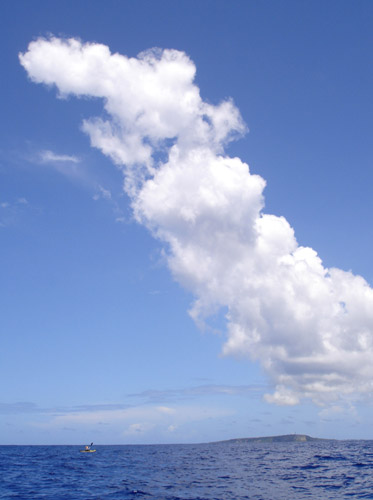
The ferry ship eased out of Kagoshima New Port shortly after midnight on Aug. 6th, bound for Naha, Okinawa. We stood on the top deck and watched the lights of the city slide by. Our kayaks, loaded with two weeks of provisions and necessary equipment, were somewhere in the hold below. Another precious 2-week holiday had begun. We were heading south where the sea is brilliant blue and full of promise of adventure.

kayak trip map

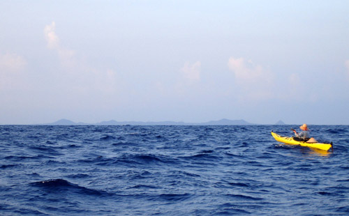
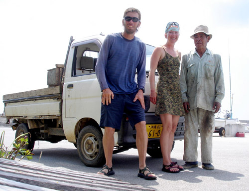
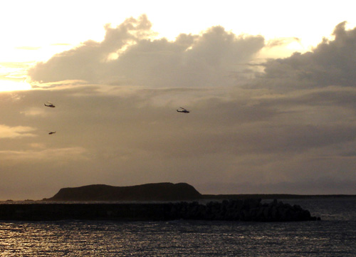
At 7pm the next day, exactly 24 hours after leaving Amakusa, we arrived at the expansive Naha New Port. In the fading daylight we hastily packed the boats and slid them down the narrow stairs of the tall concrete wharf into the tepid water. Awkwardly we launched; passing directly under the immense overhang of our ferry’s stern. We paddled along the long wharf, then an even longer breakwater; by the time we made it to the lighthouse at its end it was already quite dark. We stuck close to the tetrapods while a solitary vessel went by; we were invisible to them, which was just as well. Then finally, we paddled past the light into open water. A Jumbo Jet roared close overhead to land a short distance away at the Naha International Airport, built right on top of the shallow coral reefs that fringe every island here.

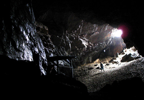
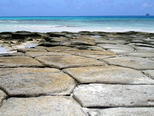
10km further west, under a full moon and a myriad lights illuminating brownish clouds over the city well behind us, we neared a group of reefs called Keise-jima, planning to camp on one of the sandbanks in the center. On attempting to penetrate the reef, however, we quickly became beached in shallow water still far away from dry sand. Realizing the inherent difficulties of doing this at night, and not feeling particularly sleepy anyway, we re-crossed into deep sea and headed another 12km west to Mae-shima, where an artificial channel through the reef was marked in the map. This we located without difficulty with the help of the GPS; it led to (surprise) an abandoned “deserted island beach and camping area” such as are (or had been) popular everywhere we’ve been so far in Japan. They were someone’s potentially clever idea to make a few bucks, but a general lack of tourist interest and the devastating forces of the typhoons usually get the better of these places. Here too, everything was in utter disrepair and we finally set the tent on the broken pier where we had landed.

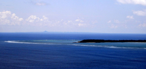
The morning’s heat woke us up. We looked around at the scenery for the first time in full color. We were on the doorstep of the Kerama Islands, a tiny but well-known destination for Japanese sea-lovers. Through a geographic accident three or four of the small islands almost completely enclose an area of sea and reefs, which consequently remains relatively free of waves and yet clean and teeming with life. Thus the islands are popular with divers, whale-watchers, and the like.
nemo2
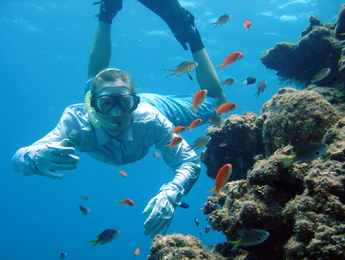
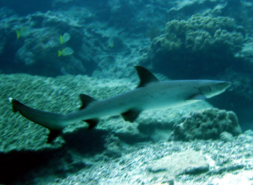
During our preliminary research we even found processed satellite images revealing in great detail the location of coral for this area. Aiming for one such place now, we found we weren’t the only ones in the know: a bevy of rubber-clad divers was already plopping into the water from a number of moored motorboats. Full of curiosity, we pulled up our kayaks on the beach, donned our snorkel gear, and swam out for a look.
clam1
clam2
clam3
clam4
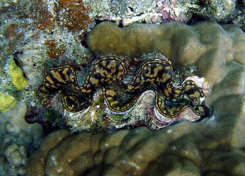
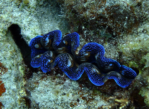
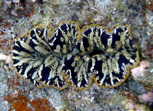
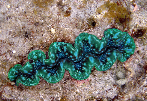
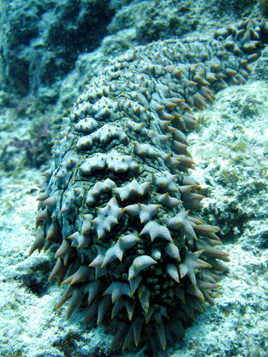
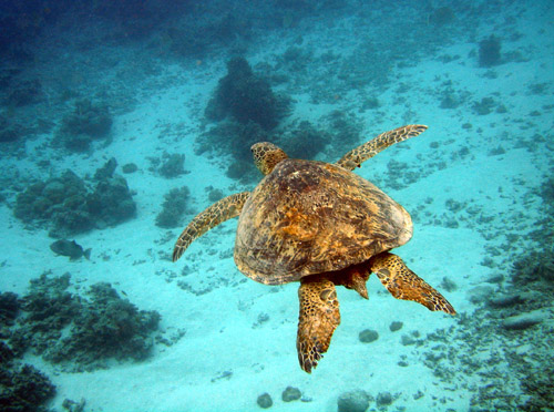
The water was pleasantly warm and a number of sea creatures could be seen on the seabed where rocks protruded from the sandy bottom. Large clams somehow perfectly fitted into pockets in the rock, and their delicate, colorful flesh revealed sinuous silky designs of many different colors.
whale
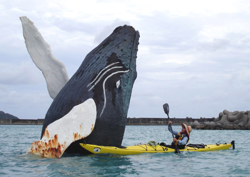
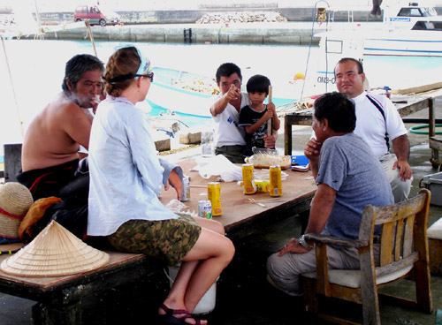
Though we didn’t plan on it, curiosity somehow pulled us into the village of Zamami located on an island of the same name. A highly realistic whale “sculpture” reared out of the water at the port entrance. In the village we had geocoded a kayak shop so after an unexpectedly delicious and cheap lunch at the local cafeteria-style restaurant (with a great view of the seascape to boot), we wandered there. This was lucky in a way because at Kerama Kayak Centre, the staff was friendly and gave us access to their Internet and sea charts, and we received a day’s warning of an incoming typhoon. All operations in the archipelago were to cease for the next 3 days. Knowing the Japanese to be overly cautious, we consulted our own sources and discovered that the next day would still be OK, but the typhoon would pass close on the day after next, making movement out of the question. The third day would again probably be OK.

This sent us scratching our heads. Slurping shaved ice on the street corner we formulated a plan: we would hang around tomorrow, then wait out the storm at a likely beach on nearby Aka Island, in the lee of the expected winds. We figured we would be protected from the onslaught of the storm by the mountain in the island’s center. Although a small town exists on the island, it would be on the windward side and we would have no recourse to civilization during the storm, as the map showed no roads or trails through the dense jungle backing the beach. Having never done this before, we felt somewhat apprehensive.
kushibaru1
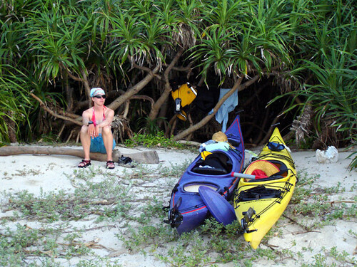
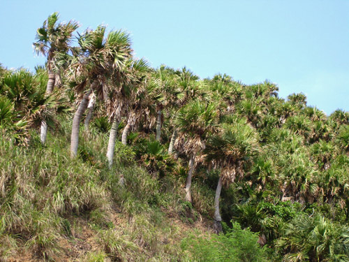
But after a short crossing, arriving at our beach, we found a dense clump of adan palm trees with a perfect space to camp underneath. The trunks and branches were short and flexible and would protect us from the storm without danger of breaking. The beach was high and in any case completely enclosed by a wide arc of reef where storm waves (though we did not expect any to come from this direction) would surely break up. Thus placated, we settled down and spent a quiet, peaceful evening and night.
sakubaru
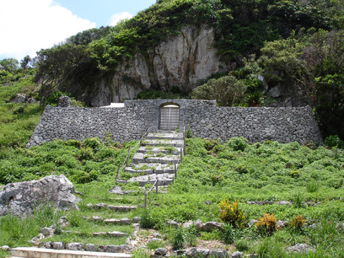
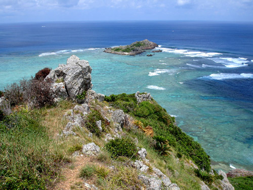
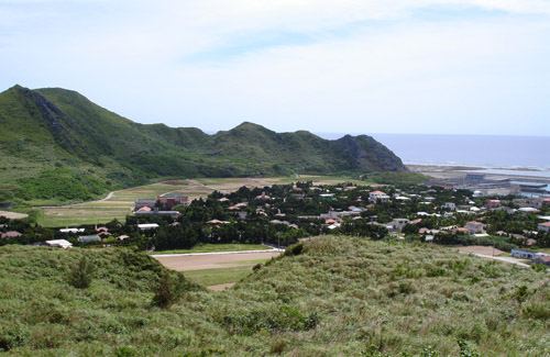
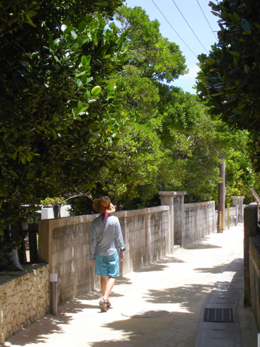
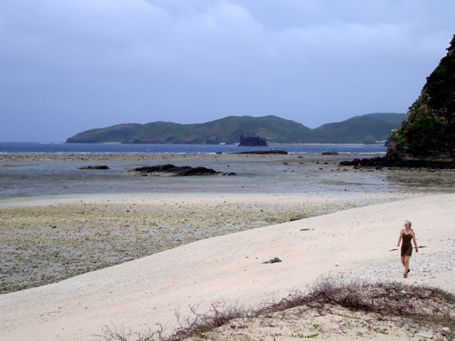
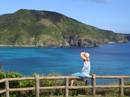
At the Sakubaru viewpoint on Akashima.

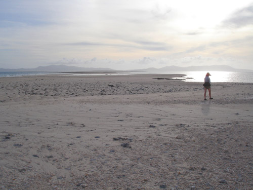
The weather the next day was glorious, as it nearly always is the day before a typhoon. The sky and the sea were a rich, deep blue. A stiff southeast breeze was the only obvious precursor to the storm. Since the weather was again behaving according to our expectations, we merrily ignored the Japanese warnings and set out on a most enjoyable circumnavigation of Aka and Geruma islands.
geruma-kitchen
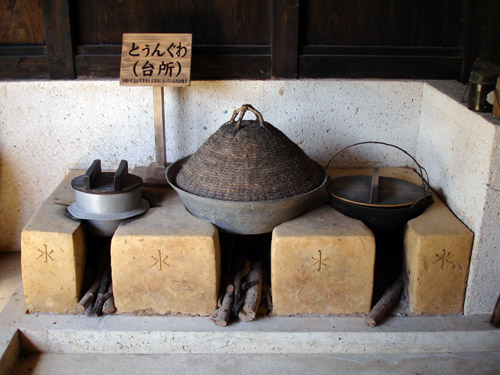
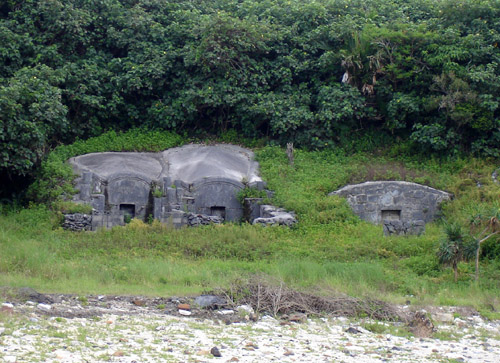
In the town of Geruma we visited a traditional house built about 150 years ago by a wealthy merchant. The elderly caretaker showed us pieces of WW2 shrapnel still embedded in the woodwork; apparently Kerama was the first place during the war to be attacked by American bombers.
wall
Like most rural buildings in Okinawa, the house was surrounded by neat stone walls to protect it from typhoon winds, and, like all traditional Japanese dwellings, exuded the sense of balance with its surroundings that is so strikingly absent from nearly all modern structures here.
sanshin
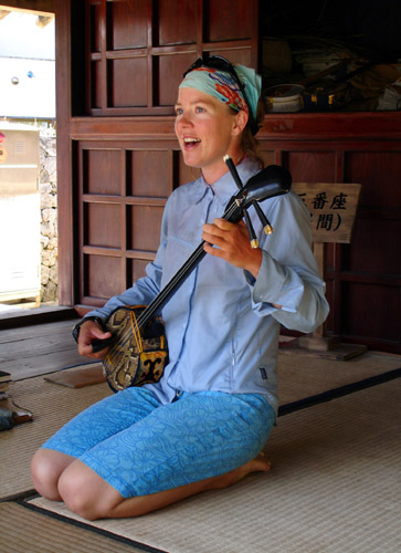
Like everywhere in Okinawa, a sanshin was at hand, and Leanne could not resist playing a tune or two, much to the delight of the old man who lamented that young people don’t learn traditional things anymore. How odd it must have seemed to him that a foreigner would paddle all the way here on a small boat, then pick up the local instrument and break into traditional Okinawa song. But he seemed to take it all in stride and told us which of the islands we were going to visit had the very poisonous, much feared but actually fairly rare snake called habu. He did not seem fazed at all by the hazard of the impending typhoon and approved of our plan to weather it, being familiar with the beach we chose and its orientation. He even told the neighboring innkeeper’s daughters that they are wasting their time boarding up the inn’s windows. “It’s not gonna be that bad”, he said. A bit embarrassed, they nevertheless continued their work.

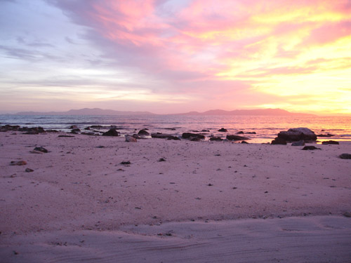
We arrived back at our campsite just in time for a beautiful sunset. We listened to the typhoon reports on the AM radio, ignoring all information except the factual reports of its position, barometric pressure, and measured winds. Our campsite was just about line-of-sight with the cell phone antenna over Zamami village, and the phone occasionally sprang to life with more accurate forecasts pulled from the Internet and sent to us from Amakusa by our friend Kenji. Not much stood changed in the new forecasts; the typhoon would pass about 160km to the south of us at 6pm the next day. Final preparations were made, all things were put in waterproof bags and packed away; the boats were hauled into the thicket and tied to the trees with rope. We figured if things got bad we’d take down the tent and sit it out in the open under our clump of bushes.
kushibaru3
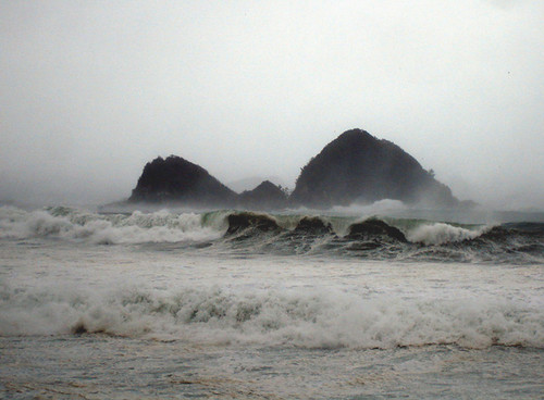
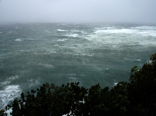
It turned out we chose our location so well we never witnessed the storm in its full fury. Sure it was quite windy the next day, the sea was gray and heaving and gusts of wind were whipping salt water high in the air, but the full blasts of wind and the huge waves that must have battered the other side of the archipelago never reached us. Even at the height of the storm we could take a walk back and forth along our private beach, being blown by the wind only a little. We realized that being able to move before a storm and set up camp in a safe place is a very powerful strategy compared to, for example, weathering storms in our flimsy house back in Amakusa, where we had felt genuinely frightened on several past occasions. Here it was not even necessary to take down the tent and we spent the day in comfort lounging, listening to American National Public Radio (relayed through by one of Okinawa’s U.S. military bases), and napping. We would have to work hard during the next few days to catch up to schedule, so it was just as well we could use this day to gather strength.


Subscribe in a reader
[View Guestbook] [Sign Guestbook]