Okinawa Kayak trip, Summer 2006, Part 5
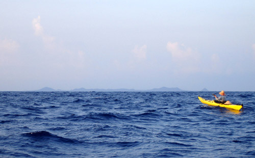
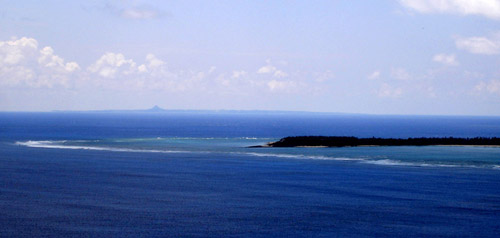
Soon we were past the Captain’s fishing grounds at the eastern point of Ie-jima, heading for the distant hills of the Izena-Iheya archipelago. This odd group of islands had aroused curiosity in us. Izena, the southern of the two larger islands, is round and relatively flat, except for several steep conical hills scattered here and there. Iheya, on the other hand, is long and narrow, with a dinosaur spine of tall mountains along its axis. Between the mountains are steep gaps that drop nearly to the sea, so that from the east or west, the island must appear as a line of mountainous islets. From our angle, it looked as one tall mountain only. This time, luck smiled on us and we were picked up by a helpful current only a few kilometers out from Ie-jima; this helped us until sunset when the sea calmed completely. It was very dark as we approached the reefs but the narrow channel was clearly marked on our GPS map and we soon picked out its marking light in the night scenery. We then headed to a tiny port where we easily found the boat ramp. Just beside was a fresh lawn and a great place to camp. Content with our relatively quick 8½ hour traverse, we had energy left over and after unpacking, we took a leisurely midnight stroll through the sleeping town with its stone and concrete walls and low houses, squat against the force of the typhoons. Finally we settled into our tent for a comfortable, restful sleep.
We put in leisurely and not too early the next morning. For two days a strong northwest wind would be blowing: a side effect of yet another typhoon passing safely to the north of us. We would not venture on the open sea today or tomorrow, and conveniently shielded from the worst of the wind and waves by the islands, we would therefore enjoy two leisurely days paddling to cape Dana, the northernmost point of Iheya.
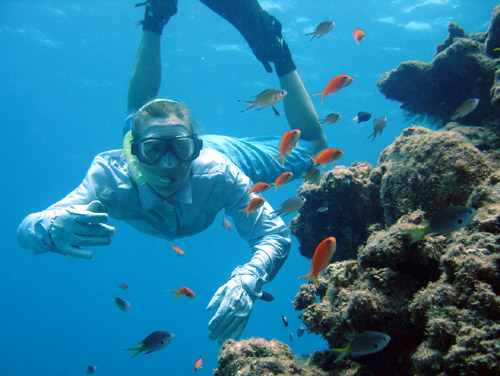
Seeing a nice beach soon after we set off, we thought, why not do some snorkeling here too.
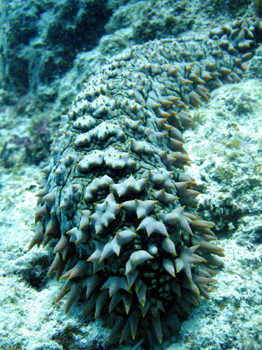
A horny sea cucumber.
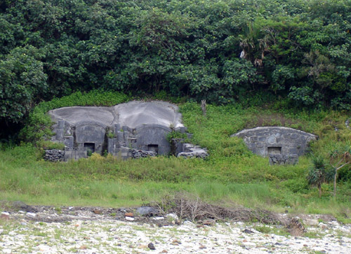
Continuing on our way after a refreshing swim we take time to look at some ancient tombs. These tombs made in the image of a mother’s womb are large sturdy structures, which hold remains of an entire family.
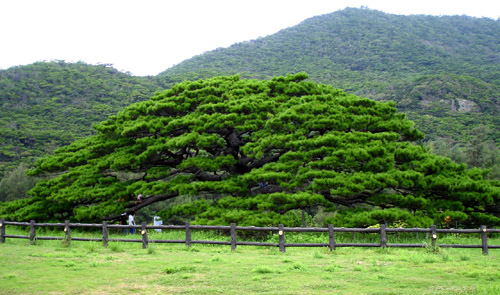
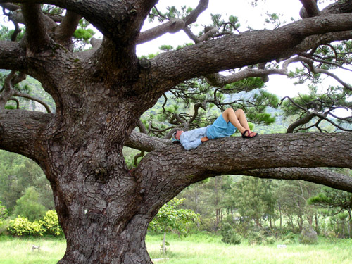
The ancient Nentou Hiramatsu, a giant umbrella shaped Ryukyuan pine tree provides an ideal place for a nap.
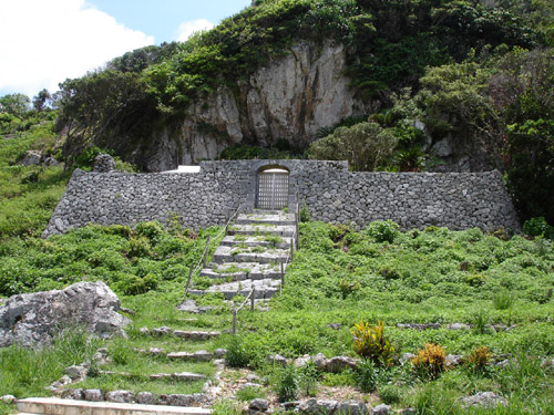
Izena Island is also famous as the birthplace of King Sho En, the founder of the Second Sho Dynasty in the Ryukyu islands which lasted until 1879, when the Japanese government brought the Ryukyu kingdom to an end and announced the establishment of Okinawa prefecture. Ruins of a castle from the 14th century can be seen at the base of this mountain.
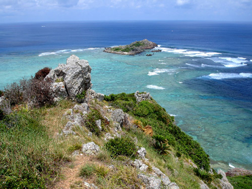
Jagged rock outcroppings and crystal clear turquoise water.
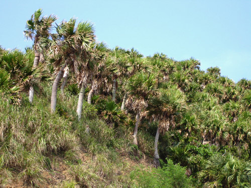
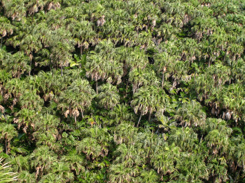
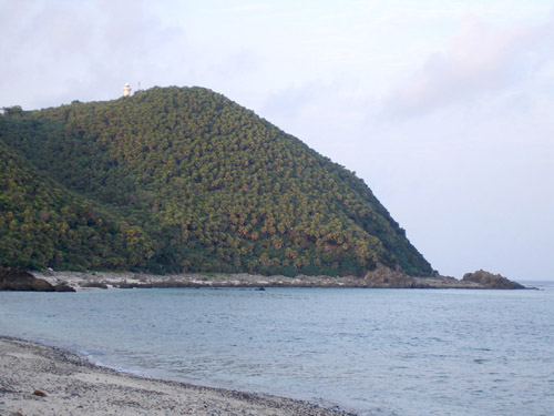
The northwestern winds continue to rage, but we rarely notice as we move leisurely up the eastern coast of Izena. By noon of the second day we have made it to the cape. We can’t move any further in this weather. In order to check out the sea conditions we climb up the road to the top of Mt. Kuba where there is a lighthouse. This mountain is famous for its palm trees, which are called Kuba trees in the local dialect.
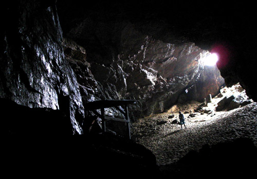
Deciding that conditions would be manageable for the traverse in the morning, we set out exploring the Kumaya cave found near the cape.
posted by Leanne and Rik Brezina at
12:41 pm
![]()


0 Comments:
Post a Comment
<< Home