Sekiryo Marathon 脊梁山地 トレッキング
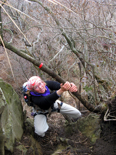
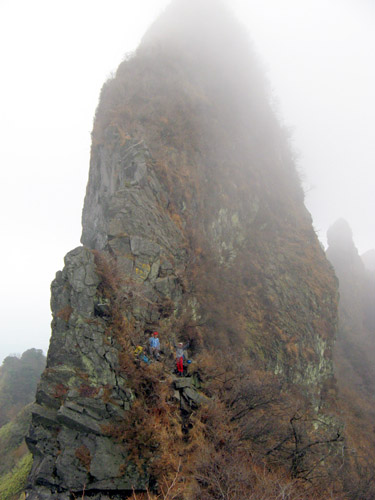
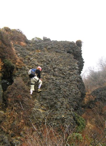
Last weekend, we did this hike as a part of our cold-weather training for an upcoming winter bicycle tour in Shikoku. It is about 50km in total length and took us 17 1/2 hours of walking time over two days; we carried fairly heavy packs with winter camping gear. The trails in the Sekiryo are typically narrow with many obstacles, so progress is typically limited to 2-3km/h. The set of trails on this hike is actually easier than what is typical here, and the northern section has recently been improved by cutting a wider swath through the thick bamboo grass.
今年のお正月休み、四国へ自転車の旅に行こうと決めました。寒さに強くなる為に先週末ハイキングに行きました。バックパックに冬用キャンプ道具を背負って二日間でおよそ17.5時間で50キロのハイキングコースをしました。脊梁山地の山道は一般的に細くて障害物が多いので平均スピードは時速2-3kmしかできなかった。今回のコースの笹に覆われた北部は最近広くしてあるので通りやすくなって、脊梁山地のほかの小道より歩きやすくなっていました。
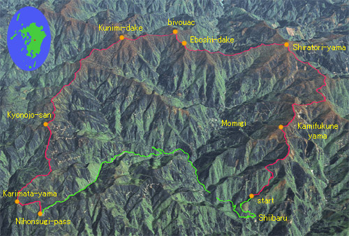
A simulated aerial view of the central Sekiryo area (using satellite imagery lifted from Yahoo Maps), showing our hike (in red) the car recovery route (20km, done by bicycle, in green), and the names of some of the major summits and some villages. After a hefty climb to reach the first summit, the trails we chose remain on the relatively gentle ridgetops and so the elevation gains on the tour are moderate though not insignificant. As few people visit the area, especially in winter, one is guaranteed quiet and solitude on this tour. 脊梁山地のシミュレーション航空写真で今回のコースが示しています。ハイキングコースは赤で自転車のコースは緑。
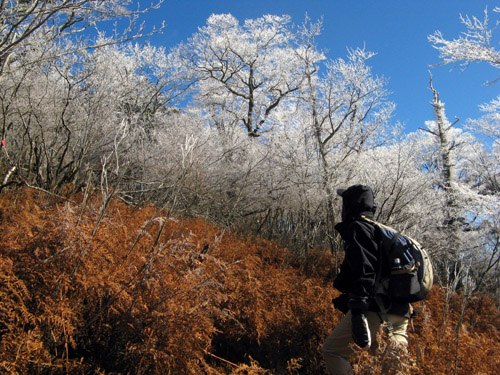
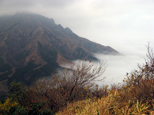
And cold weather training we did get! Especially on the first day, the air was bitter with biting cold and wind. Clouds enveloped the upper ridges all day and the fog froze on the trees to reveal spectacular rime frost scenery when the clouds lifted occasionally. 最初の日は期待した以上に寒くて、大きいな冷蔵庫の中みたいでした。樹氷が感動的でした。
On the morning of the second day, we reached Kunimi-dake, at 1739m the highest peak in the Sekiryo, to be rewarded with unlimited views of the entire island of Kyushu in the crystal-clear air, from the Oosumi peninsula 150km to the south to the mountains of Fukuoka prefecture more than 100km to the north. A fitting reward for enduring the previous cold day and night.
2日間目の朝脊梁山地の一番高い山の国見岳(1739m)の頂上に登り詰めました。
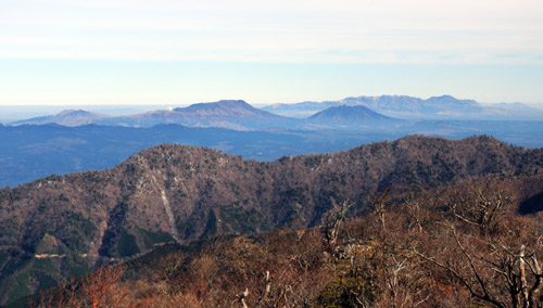
The Aso caldera looks very close in this view from Kunimi-dake in the clear morning air. Beyond the karst peak of Tenshuzan (foreground) the south part of the large crater rim shows as a dark ridge. Beyond, the steaming Aso massif, with Nekodake on the right. (See previous blog entry for reference.) Beyond Nekodake, the Kuju Peaks, yet another group of active volcanoes, rise to heights of over 1800m.
A closeup of the Aso peaks, symbol of Kumamoto Prefecture. Steam rises from the most active crater.
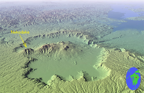
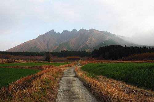
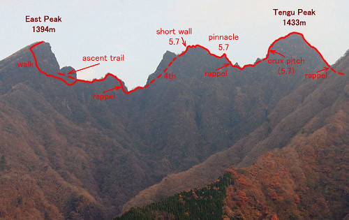
A closeup of Nekodake, which we climbed last week. We vividly recall every bump in that jagged ridge we climbed over. Beyond, clarity of the Kuju peaks belies their 60km distance. Nekodake itself is about 40km from the camera.
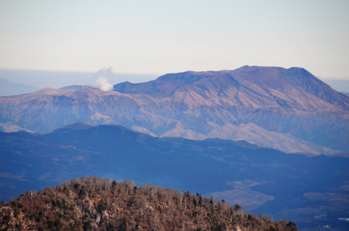
More volcanoes! To the west, Mt. Unzen, located in Nagasaki Prefecture not too far from our home. It is presently dormant but the lighter colored main peak was formed in its entirety in a huge eruption only about 20 years ago.
To round out the volcanic views, Sakurajima near Kagoshima city could also be seen erupting a tall column of dark dust, far to the south. Sakurajima's been increaingly active lately, with a major eruption possible in the near future that will endanger the very nearby city. The erupting dust clouds can lately be seen even from low-lying Amakusa.
In the east, the pointed Sobo Peaks of Oita Prefecture present a sharp silhouette. Some rime frost remains on the Sekiryo ridges in the foreground.
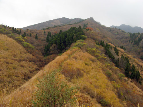
Looking southeast into the deep Shiiba Valley of Miyazaki Prefecture - a view that typifies the Sekiryo topography. The mountain in the distance is Osuzuyama, near the Pacific coast, a reportedly scenic place that we have yet to visit.
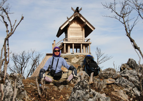
Leanne takes a well-deserved break by the summit shrine on Kunimi-dake
while I snap pictures in every direction.
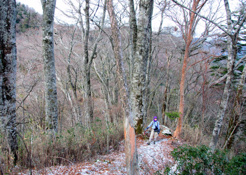
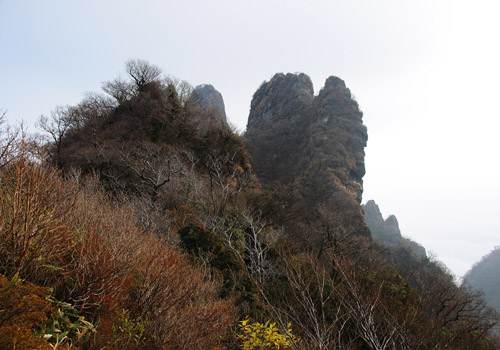
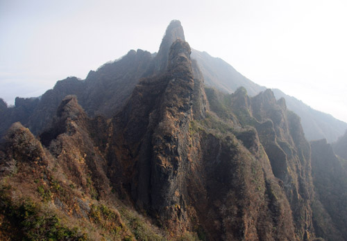
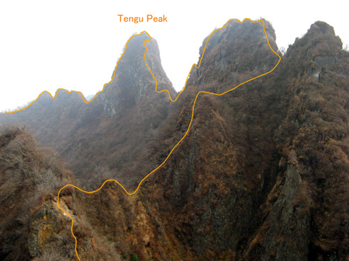
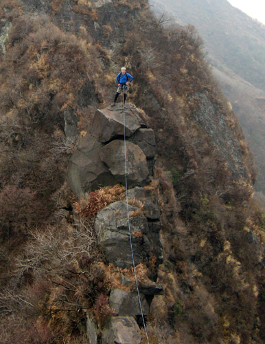
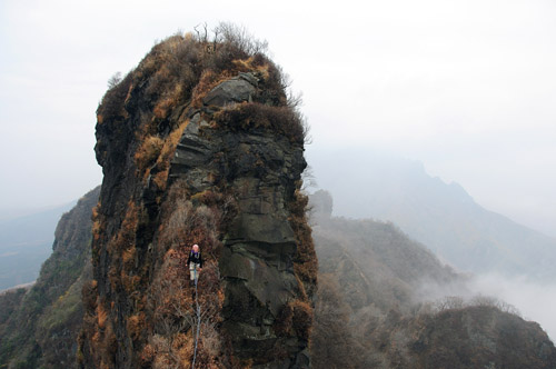
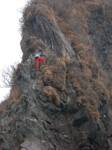
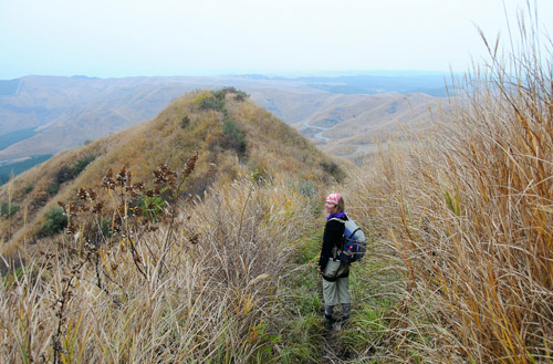
Trekking along the ridge in the virgin forest which is Sekiryo's main treasure. Such areas of relatively undisturbed nature are very rare in Japan, and seemingly becoming more so every year.
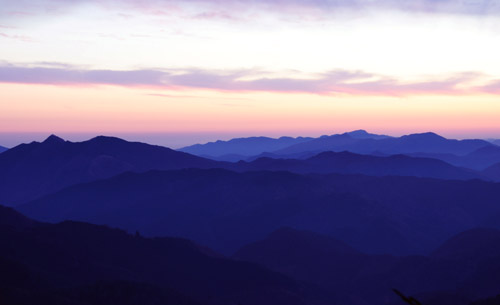
Great timing. The sun goes down upon reaching Karimata-yama, the last summit of the tour, casting the overlapping ridges in purple shades.
Hiking by headlamp, we are out on the road through Nihonsugi Pass within an hour after Karimata. Another hour or two later, after an exciting down and up hill in the dark, we've recovered the car and head for a soak in the hot spring, followed by an Indian curry dinner. Ah, the luxuries of life!
今年のお正月休み、四国へ自転車の旅に行こうと決めました。寒さに強くなる為に先週末ハイキングに行きました。バックパックに冬用キャンプ道具を背負って二日間でおよそ17.5時間で50キロのハイキングコースをしました。脊梁山地の山道は一般的に細くて障害物が多いので平均スピードは時速2-3kmしかできなかった。今回のコースの笹に覆われた北部は最近広くしてあるので通りやすくなって、脊梁山地のほかの小道より歩きやすくなっていました。
A simulated aerial view of the central Sekiryo area (using satellite imagery lifted from Yahoo Maps), showing our hike (in red) the car recovery route (20km, done by bicycle, in green), and the names of some of the major summits and some villages. After a hefty climb to reach the first summit, the trails we chose remain on the relatively gentle ridgetops and so the elevation gains on the tour are moderate though not insignificant. As few people visit the area, especially in winter, one is guaranteed quiet and solitude on this tour. 脊梁山地のシミュレーション航空写真で今回のコースが示しています。ハイキングコースは赤で自転車のコースは緑。
And cold weather training we did get! Especially on the first day, the air was bitter with biting cold and wind. Clouds enveloped the upper ridges all day and the fog froze on the trees to reveal spectacular rime frost scenery when the clouds lifted occasionally. 最初の日は期待した以上に寒くて、大きいな冷蔵庫の中みたいでした。樹氷が感動的でした。
On the morning of the second day, we reached Kunimi-dake, at 1739m the highest peak in the Sekiryo, to be rewarded with unlimited views of the entire island of Kyushu in the crystal-clear air, from the Oosumi peninsula 150km to the south to the mountains of Fukuoka prefecture more than 100km to the north. A fitting reward for enduring the previous cold day and night.
2日間目の朝脊梁山地の一番高い山の国見岳(1739m)の頂上に登り詰めました。
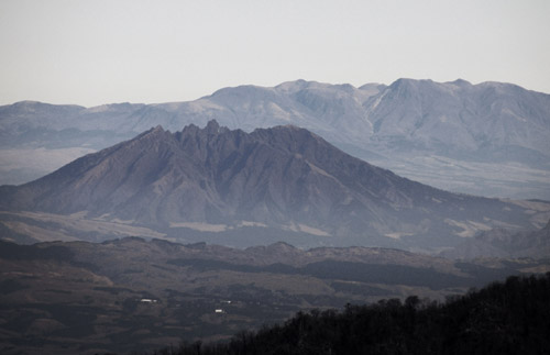
The Aso caldera looks very close in this view from Kunimi-dake in the clear morning air. Beyond the karst peak of Tenshuzan (foreground) the south part of the large crater rim shows as a dark ridge. Beyond, the steaming Aso massif, with Nekodake on the right. (See previous blog entry for reference.) Beyond Nekodake, the Kuju Peaks, yet another group of active volcanoes, rise to heights of over 1800m.
A closeup of the Aso peaks, symbol of Kumamoto Prefecture. Steam rises from the most active crater.
A closeup of Nekodake, which we climbed last week. We vividly recall every bump in that jagged ridge we climbed over. Beyond, clarity of the Kuju peaks belies their 60km distance. Nekodake itself is about 40km from the camera.
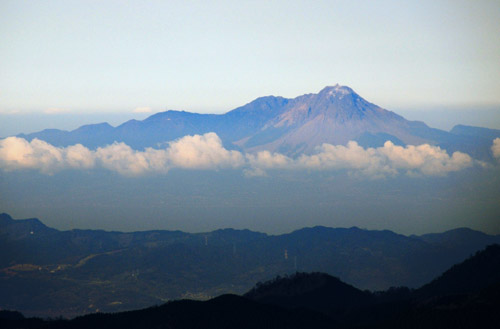
More volcanoes! To the west, Mt. Unzen, located in Nagasaki Prefecture not too far from our home. It is presently dormant but the lighter colored main peak was formed in its entirety in a huge eruption only about 20 years ago.
To round out the volcanic views, Sakurajima near Kagoshima city could also be seen erupting a tall column of dark dust, far to the south. Sakurajima's been increaingly active lately, with a major eruption possible in the near future that will endanger the very nearby city. The erupting dust clouds can lately be seen even from low-lying Amakusa.
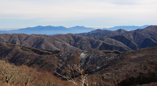
In the east, the pointed Sobo Peaks of Oita Prefecture present a sharp silhouette. Some rime frost remains on the Sekiryo ridges in the foreground.
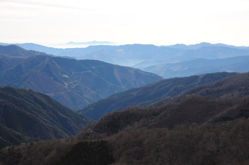
Looking southeast into the deep Shiiba Valley of Miyazaki Prefecture - a view that typifies the Sekiryo topography. The mountain in the distance is Osuzuyama, near the Pacific coast, a reportedly scenic place that we have yet to visit.
Leanne takes a well-deserved break by the summit shrine on Kunimi-dake
while I snap pictures in every direction.
Trekking along the ridge in the virgin forest which is Sekiryo's main treasure. Such areas of relatively undisturbed nature are very rare in Japan, and seemingly becoming more so every year.
Great timing. The sun goes down upon reaching Karimata-yama, the last summit of the tour, casting the overlapping ridges in purple shades.
Hiking by headlamp, we are out on the road through Nihonsugi Pass within an hour after Karimata. Another hour or two later, after an exciting down and up hill in the dark, we've recovered the car and head for a soak in the hot spring, followed by an Indian curry dinner. Ah, the luxuries of life!
posted by Leanne and Rik Brezina at
1:12 pm
|
2 comments
![]()