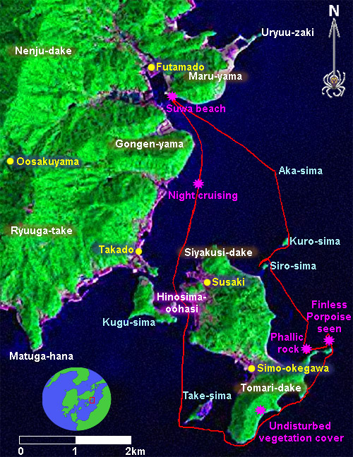
HINOSHIMA CIRCUMNAVIGATION
Total Distance- 17km
A nice leisurely trip.
The background image in this map is a Landsat false color composite with mountain shading based on a digital elevation model. The track is based on GPS data.
A nice leisurely trip.
The background image in this map is a Landsat false color composite with mountain shading based on a digital elevation model. The track is based on GPS data.
posted by Leanne and Rik Brezina at
1:12 am
![]()


0 Comments:
Post a Comment
<< Home