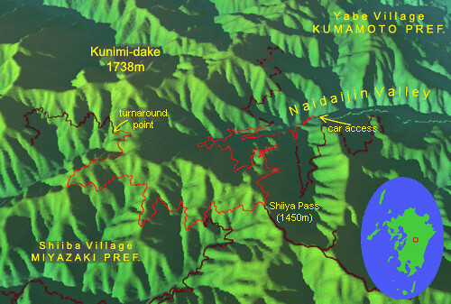
Shiiya Pass is part of a scenic mountainous area called variously the 'Central Kyushu Mountains' or 'Kyushu Backbone Range'. It is our favorite part of Kyushu. There are a few reasons for this: here is an extensive maze of steep mountains and deep valleys; access is difficult enough to make it Kyushu’s most remote place (and one of the most wayward areas of Japan); the mountain ridges have excellent hiking trails amidst the most extensive undisturbed forest in this part of the country (and that’s really saying something)...well, you get the idea.

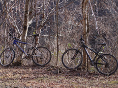
Just before a weekend in early March, we were let know by some of our local climbing cohorts that there was going to be a “revolt” at our favorite climbing area. Being basically peaceful people ourselves, we took this as bad news. The Japanese can’t tell the difference between a ‘b’ and a ‘v’, so in the end we figured some bolts were to be replaced; anyways with the cliff under construction climbing wouldn’t be any fun. The day was too good to waste though, clear and warm as it was, especially with another cold wave on its heels. So we brushed the cobwebs off our mountain bikes, loaded them into our mini-car and headed for the hills. Our goal this time was an exploration of some crazy mountain roads built where roads cannot and should not ever be built. But such is the nature of the japanese struggle against nature, that building must proceed, ludicrous that it is. And therefore, roads, or what is left of them, are there to be found in the most unlikely places, such as on the slopes of even the highest and steepest mountains.
Typhoons have been increasing in intensity and number the past few years and the last three summers in particular wreaked complete havoc on central Kyushu. Virtually all mountain roads here had been destroyed by floods or landslides, the severity of which was amended by man-made disturbance of the mountain and its vegetation cover in the first place. The disasters left dozens of villages completely stranded for months, put an end to the operation of a mountain railroad, and generally made the mountains inaccessible by conventional means for years to come. It is unlikely that some roads will or can be rebuilt at all. There is nearly no solid rock in these mountains. They are literally made of dirt and boulders; slopes sit at a delicate angle where the slightest disturbance will trigger a massive slide that may render rebuilding unfeasible no matter how much concrete is poured. Reconstruction continues out of necessity to spend taxpayers’ money on something, and to employ what's left of the dwindling rural population, but in the meanwhile, most mountain roads remain off limits to cars– a perfect situation for the mountain biker who, shouldering her bike, can climb over a mudslide or two. As the climate trend continues, the new construction too will soon be washed away and the mountains may permanently become the realm of mountain bikers and hikers only. Maybe global warming is not such a bad thing after all!

Our goal this weekend was, first of all, Shiiya Pass at 1450m, a slight dip in the mountainous spine of Kyushu and a route between two of the most remote regions of Kumamoto and Miyazaki prefectures. There has been a cleverly constructed road here for some time, and it was of some use before the area became depopulated. Now it’s popular mainly with 4x4 enthusiasts, but there’d be none now because even they can’t get past the landslides. Once over the pass, we would descend slightly, then enter a long ‘forest road’, which attempts to contour the steep mountainside for 18km and ends in the middle of absolutely nowhere. Then we would retrace our route back to our car.
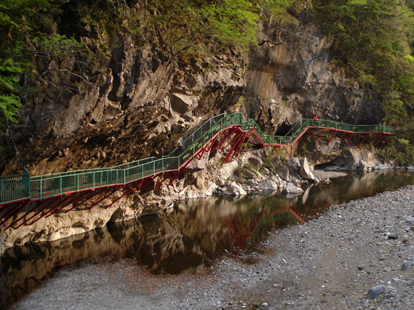
Crossing the airy Naidaijin Bridge over the Midori River canyon, we entered the core of the Central Mountains. Soon, signs warned us that the road ahead was indeed impassable. 650m above sea level was as high as we could drive, so we left the car there and equipped the bikes, carrying them over a 100 meter area where the river had washed away the road, currently under reconstruction. On the other side, a forest patrol car was parked (how did it get there?) We pedaled past quietly thinking a ranger may be asleep inside (the Japanese love to sleep in their vehicles while on the job – can’t blame them, with their crazy work hours). No stirrings from the car, so we were home free.

We put foot to the pedal and in two hours, we found ourselves out of the deep, in-cut valley and on the mountain ridge that forms the very backbone of Kyushu, and the boundary between Kumamoto and Miyazaki Prefectures. Shiiya Pass was as we remembered it from hiking the length of the ridge 2 years ago; then it was instead a low point of the trip. Up to here was a long, gentle, steady hill and the road was not in bad shape. Puddles on the road from the occasional patches of melting snow attracted huge toads; they were now mating and laying eggs in anticipation of the coming spring.
Some distance down the other side, we encountered the start of the forest road branch we had set out to explore (also signed impassable), and ventured forth. Here our progress slowed considerably. Many parts of the road were covered by rocks or gravel ever spilling from the steep slopes above. Generally the surface was soft and loose, and the road did not truly contour, rather, it climbed where it crossed ridges and descended while intersecting valleys.
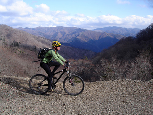 Leanne contours the precarious mountain slope with spreading views of mountains in Miyazaki Prefecture behind her.
By our usual standards, these hills were not severe but we hadn’t biked in months and 1500 vertical meters of climbing on loose surfaces was beginning to wear us down. We reached the road’s high point an hour before sunset in a state of advancing fatigue. Leanne waited here as I continued downhill some kilometers further. However, I was tired too, darkness was fast approaching, and a spreading view of the rest of the road revealed that it descended considerably before ending in the middle of the bush. 6km short of the end, I cut my losses and turned back. We still had to get back to where we came from!
The light of day faded and our headlamps came out. Rain suddenly seemed imminent and electronics were put away in plastic bags. The weather had turned with surprising speed just as the sun went down. We knew a storm was coming but we gambled on the accuracy of the forecast which said it would not rain until midnight. But now the high dark hills around us cast a tangible doubt over our decision-making. Yet for now, only light showers came down. Our eyes became accustomed to the dim light of the lamps as we avoided loose rocks and fallen branches, all the while keeping the ever-present steep drop to the right at a safe distance. At the junction we lay on the ground a while, gathering strength for the final hill. From Shiiya Pass, it would be all downhill; as long as we do not run off the road we will be okay.
Gusts of chilly wind buffeted us at the pass. From there it still took more than one hour to get to our car, even though we rode a little faster than we should have. The eyes of wild animals frequently reflected the light of our headlamps: deer, coon dogs, weasels, and others are much more common here than perhaps anywhere else in Kyushu. Landmarks remembered from the climb were left behind in slow succession, and with the GPS stowed, only the elevation indicated on my watch showed the (vertical) distance left to go. Finally we pushed our bikes between the ghostly, greasy-smelling machines of the construction site, and reached our car.
Driving back, the rain began in earnest. The weather forecast was dead on, but we were still lucky not to get soaked. Our quadriceps, idle for some months, were now cramping due to exercise overload. We popped some Ibuprofens, which we carry in our car just for such cases. On our empty stomachs, the drug took effect almost immediately and the cramping and pain were much diminished, leaving only the excitement of the day undiminished: we had rediscovered how much fun biking in the mountains can be.
Total distance: 54km
Total elevation climbed: 1600m
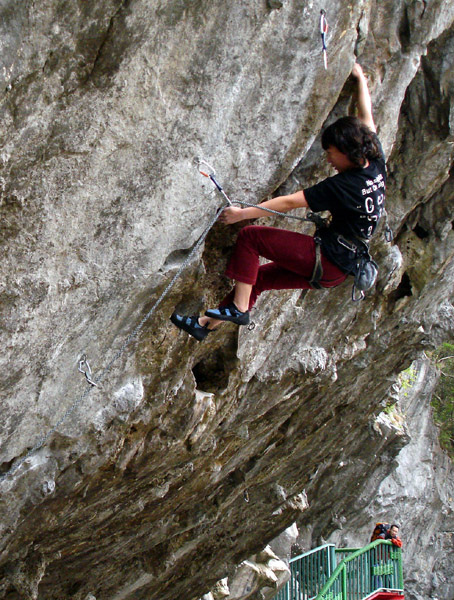
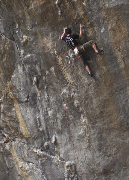
 Mr. Kappa says, If you grab the quickdraw, you owe me a beer.
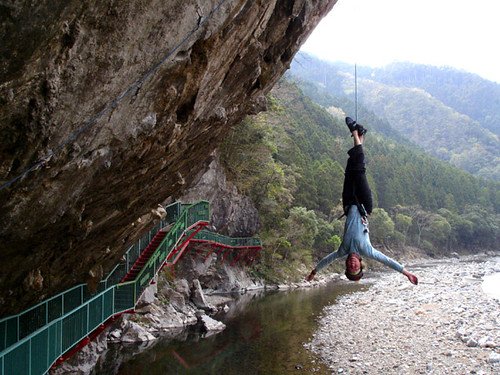