Poking around Yushima - 湯島へぶらっと行こう
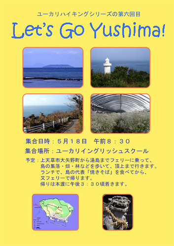
A poster I threw together to attract interested parties to our school's annual hike. Every year we go to a different, (hopefully) interesting place of our choice in Amakusa. Note the intentional English error, following the 'rules' of a common Japanization of our language - if you can't beat them, join'em! To their credit, the more alert students actually noticed.
Last Sunday we went to Yushima with some students from our beloved Eucalyptus English School (EES). Yushima is a relatively isolated island in Amakusa, offering a unique atmosphere and walking opportunities (see our previous entry). While everyone took the passenger ferry to the island (there is no car ferry as there is no use for a car there), the two of us paddled in by kayak, of course. Usually we come from Oniike, 17km to the west, but this time, we were obliged to go from the Misumi strait, 11km to the east of Yushima, to accommodate the currents that matched the timing of the trip. It was a fun, relaxing day for everyone, and so it seems the yearly EES hiking trip was a success. Here are some maps and pictures.
先週の日曜日、私達の大好きな仕事場のユーカリイングリッシュスクールの教師たちと何人かの生徒たちは、湯島へ出かけました。湯島は、天草の有人の島々の中で、比較的に孤島で有り、散歩にとてもふさわしく、ユニークな雰囲気もあります(以前の記事を参照)。私達二人もちろん湯島までカヤックで渡って、残りの皆さんはフェリーに乗ってきました。カヤックの横断は、普段に湯島から西の方へ17キロ離れた鬼池からしますが、今回の潮流の状態によって、出艇のポイントを、三角の瀬戸にある岩谷漁港に変更しました。到着時間をよく合わせて、フェリーとカヤックが、湯島港に同時に御前10:30に着きました。とにかく皆さんは、楽しくて、のんびりの一日を過しました。数枚の写真と地図を入れます。
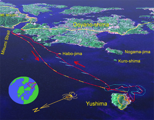
A simulated aerial view of the trip; imagery is based on LANDSAT data. The red track is our kayak trace; embedded within are yellow and light blue lines representing ebb and flood (respectively) measured current directions and speeds. The swiftest current was about 2.3kt (on the return leg) but at mid-spring tide, expect currents in excess of 3kt, with associated danger of overfalls in windy weather. It's obviously possible to make this 25km round trip very comfortably riding on the currents if your timing is right, and each way oughtn't take more than 1 1/2 hours. Also marked are paths hiked on Yushima and Habo-jima (see also below; the other yellow lines are national highways bridging Amakusa to Kyushu), and shoals to the south of Yushima are outlined in blue. Okinose, a moveable gravel bank, is located on our path directly 'above' Yushima.
湯島、三角、大矢野などの付近のバーチャル映像です。画像はLANDSATに基づいています。今回のカヤックのルートは赤線で表します。それに重なっている線は、観測した潮流の引き潮(黄色)、そして満ち潮(水色)の流れの方向及びスピードを表します。流れの最高スピードは2.3ノットでしたが、丁度大潮の時おそらく3ノット以上に成りそうですから、そんな時三角波などに注意。羽干島での黄色の線は、歩いた道です。大矢野島などでの線は、九州と天草を「天草五橋」で結ぶ国道です。湯島の南の水色線は、底にある大きな浅瀬を示します。この辺、大潮の干潮の時、島から離れた礫の浜も現れます。
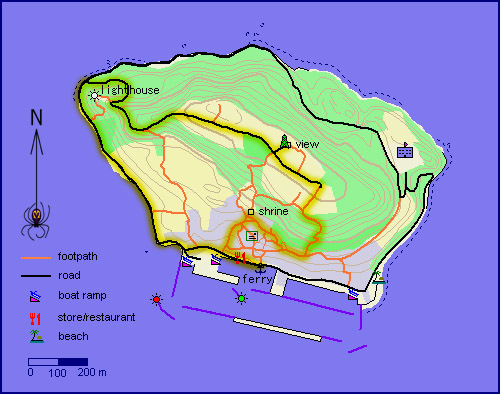
A more detailed map of Yushima also showing last Sunday's walking route, which takes in most of the island's interesting sights. The back road around the island is also highly recommended.
湯島のある程度詳しい地図です。黄色でなぞられた道は、今回の散歩のコースでした。面白くて快適でのんびりのコースですから、お勧めのコースです。

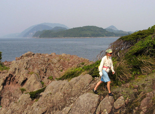
The troopers tromp through the tiny town's terraced trails.
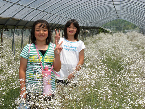
カスミソウの温室を楽しんでいるエリカとアヤカちゃん。
In the greenhouse full of Baby's Breath.
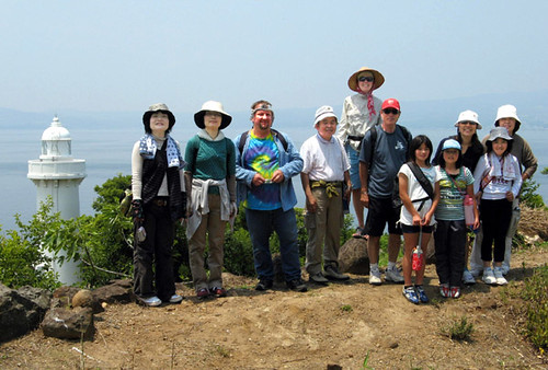
Posing by the lighthouse.

Lunch is the happiest moment of any hike. The island's yakisoba or fried noodles are not for pushovers. There is an egg in there too!
旅の一番楽しいひと時は、ランチ。この島の焼きそばは、焼き卵も含んで、美味しくてボリュームたっぷり。
When everyone departed on the 2pm ferry, it was time for us too to return. However, instead of going directly back, we took in a few interesting sights along the way. This being our first time here at low tide, we took opportunity to explore the extensive sandy shallows that lie to the south of the island. Around here we saw schools of thousands of sardine-like fish called hadara swimming about; it is their spawning season. There is also a gravelly isolated gravelly spit called Okinosu which just barely emerges from the sea at spring tides; its location was actually more than 100m from its charted position; maybe it gets moved around by storms like the several much larger sand and coral banks around Iriomote Island in Okinawa. At another place, seaweed grew thickly. So even a shoal like this is filled with mystery: why does a spit form just there, while seaweed grows here but not over there?
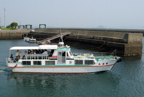
フェリーで帰っている皆さん。お疲れ様でした!
And off they go back by ferry. There is no car ferry service to Yushima as there is hardly a road here one could drive on!
私達以外、皆は午後二時のフェリーに乗って帰りました。私達も、カヤックを出して海に出かけました。しかし、直接に帰らず、あちこち探検しながら、のんびりの帰りでした。まずは、湯島の南にある巨大な浅瀬を見に行きました(水深2-3メートルの海域の面責は島とおよそ同じです)。ここで、何千匹のハダラと言う魚の群れを見ました。地元の漁師さんによって、産卵期の今頃強い潮の流れの湯島の付近で、よく見かけられます。この辺も、島からよく離れた沖ノ洲と言う大潮の干潮の時だけ海から出る礫の浜を見に行って、それは案外海図に載った位置より100メートル以上ずれていました。多分西表島にもあるこのような浜と同じく、嵐によって動かせます。あとは、浅瀬のほかの場所に、いきなり海草が茂っていた。さ、こんな浅瀬でも、十分のミステリーがあります。なんで、ちょうどそこだけ浜がある?で、あそこは海草は流行ってるけど、ここの同じような所で、なんで全くない?
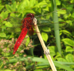
赤とんぼかな~

The tiny uninhabited islet of Habo-jima lies on the way to Misumi.
小さな無人島の羽干島です。
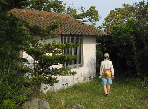
As we poked around, the tide began to pour in and the flood current picked up. This we rode eastward toward the tiny uninhabited island of Habo-jima. We’d been there only once before (during our Kami-shima circumnavigation), when we found the island’s prominent feature: a gravity-defying natural stone arch. Since then a perusal of aerial pictures revealed a well-hidden roof inside the trees. Maybe someone’s private cottage? We landed and explored; the structure turned out to be a small shrine. What a beautiful little place Habo-jima is, though; a small world unto itself. Bizarre, bare volcanic rocks along the shoreline culminate in wildly overhanging bluffs, atop which sits a small patch of thick, untouched forest. Within this green sanctuary the shrine offers a moment of quiet solitude.
The bizarrely shaped volcanic rocks of Habo-jima are of a rich brown color.
しばらくこんなにぶらっとすると、満ち潮の流れがドンドン速く成りました。それを利用して、羽干島と言う小さな無人島まで快適に乗りました。私達は依然、ここを一回だけ訪れた事が有ります。その上島の一周の時、島の代表のナチュラルの岩のアーチを発見。でもあとで、空中写真に、樹木によく隠れられた建物もあると分かりました。だれかのプライベートのコテージか。今回、上陸してから、森に入って、小さな神社を発見。なんて美しいこの羽干島の小さな世界。海岸の異様な岩が、懸崖まで続いて、その上に森の茂りに囲まれた神社で、静かなひと時を過ごせます。
Looking for a secret abode...
羽干島の探検で、秘密の場所を探しています。
Found it! It's a small shrine.
あった!小さな神社に見えます。
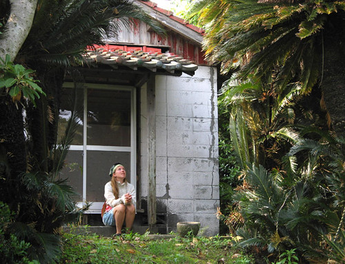
Enjoying a peaceful momet in a beautiful place.
中々いい雰囲気だった。
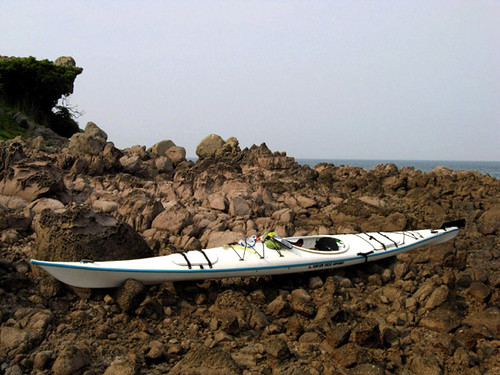
Leaving Habo-jima, we followed the attractive volcanic shoreline of Kami-shima back into the narrow, fast-flowing Misumi Strait. Arriving back at Iwaya about an hour before dark, we packed up very leisurely and chatted with the lively and friendly fishermen and local inhabitants. One of them, a Mr. Torihama, had seen us near Yushima from his fishing boat and was very surprised at the speed and efficiency of our kayaks. He had caught a cooler-full of a variety of fish, including many hadara, and he proceeded to give us a bagful, proceeding to explain in great detail how they are best prepared and eaten. We had a very nice time talking with him and a delicious fish dinner to boot after returning to our humble abode in Hondo.
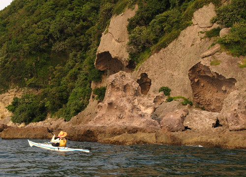
Following the coast of Ooyano Island with its interesting volcanic rocks.
大矢野島の海岸沿いに帰ります。
羽干島を出て、景色のいい火山岩の上島の北海岸を、狭くて流れの早い三角の瀬戸まで辿りました。岩谷漁港におよそ暗くなる前一時間に着いて、のんびりで装備を片付けながら、地元の人や漁師さんたちと話しに花を咲かせた。その中での一人の鳥浜と言う漁師さんは、自分の漁船から湯島の付近で私達のカヤックを見かけて、今はカヤックの早さや能率に感動しました。かれは今日釣りの大量で、クーラーボックスをいっぱい取りました。それから、ハダラを一袋分を出して、詳しい料理の説明をしながら私達に上げました。彼のいろいろな話を聞くも、内に帰ったあとで作った美味しい魚料理も、今日のたくさんの楽しい事の中で二つでした。
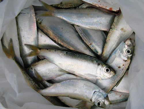
The sardine-like fish we received from Mr. Torihama (to appear later is the really cool palm-frond hat he gave us - he makes them for kicks).
鳥浜さんから貰った新鮮なハダラ。
Labels: kayak expedition シーカヤック遠征
posted by Leanne and Rik Brezina at
12:42 pm
![]()


0 Comments:
Post a Comment
<< Home