Sekiryo Mountains Part I: Hiking
We spent this past winter vacation hiking and exploring the Sekiryo Mountains in central Kyushu. As told earlier on this blog, these hills hold a special place in our relationship with the local landscape, in part because of their remoteness and relative lack of accurate maps and information. During those two winter weeks we certainly got to know the hills better. We spent the evenings in the valley villages eating local food and lounging in hot spring baths whenever possible, before pitching our tent in local campsites which were mostly abandoned for the season. Every day we set off looking for new hiking trails, our searches based partly on internet research and partly on intuition. It was fun, relaxing, healthy, and much cheaper than traveling to some faraway place.
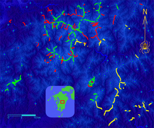
This map shows the current status of our ever ongoing Sekiryo explorations. Green lines represent surveyed trails, yellow lines are trails surveyed this winter, and red represents, to the best of our knowledge, trails still left to survey. Blue dots are named and/or significant summits. Exploring these hills is a time-consuming but interesting process, and few things are better for one's mind and body than a hearty walk in the woods. Perhaps when we finish the survey we'll make a hiking map of the area, since none exist at present.
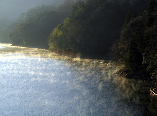
To make full use of the short winter daylight hours, we regularly woke up at dawn. Despite the short driving distance to the trailheads, the approach typically took at least an hour. Narrow, twisty, often unpaved and boulder-strewn roads cannot be traveled quickly. Our car really took a beating, but that was OK because we were about to replace it anyway. Here, morning mists drape the waters and shores of the Kamishiiba reservoir, on the way to snow-covered Mt. Goyuu.
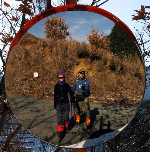
Explorers at work. Equipment included comfortable boots, gaiters (for snow and mud), Goretex coats (the weather was usually unstable), trekking poles, radios (we often split up to explore different trails), and of course, GPS units in waterproof cases. We traveled very light for speed, often not even taking a backpack. But speedy climbing is generally not possible in the Sekiryo hills, due to the rough nature of the trails.
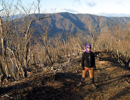
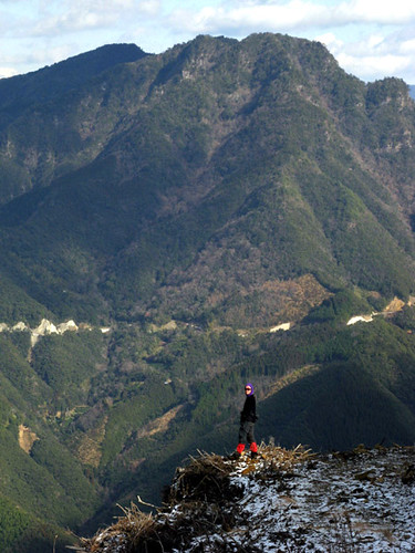
Climbing Sanpou-dake, a typical three-hour hike. Generally, we were able to do two such hikes per day, but when heavy snow fell during the second week, we had to content ourselves with one per day as both car access and the hiking became much more difficult. Although in winter there aren't the vibrant green colors and flowers one can enjoy during the other seasons, the views are better due to the clearer air and bare trees. The GPS also records more accurately withouth the obstructing foliage. Plus there are absolutely no other hikers so parking or crowded trails are certainly not a problem.

Patches of undisturbed forest left here and there on the high ridges are the treasure of the Sekiryo hills. This is what hikers really visit the area for. In the spring and summer, rare flowers can be seen here in great numbers. In the nearby plantations and clearcuts, these plants have now disappeared completely. We're always on the lookout for these natural areas and as we found them, we recorded them dutifully with the GPS. Here, we found an unexpected, naturally open patch on the traverse between Mts. Ishido and Higuchi.
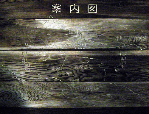
Locating the trails in the first place was a part of the challenge, a kind of treasure hunt really. Some were written up in hiking books, others, to various levels of accuracy and detail, on the internet. Still others we found while hiking, exploring, or driving the forest roads. Occasionally, a useful trail could be gleaned from locally posted maps or signs such as this one.
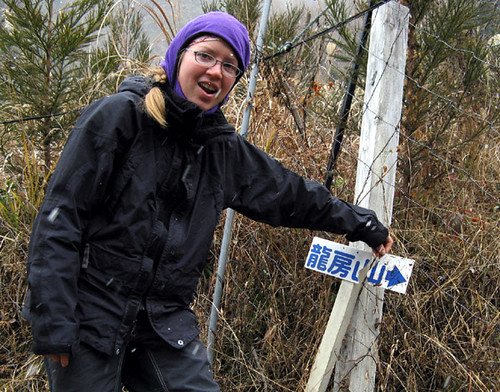
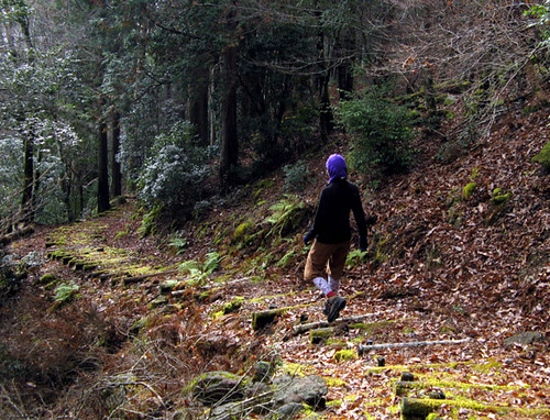
Trails in the Sekiryo are often not much traveled, and many were difficult to follow. We usually found ourselves following only tape blazes though the trackless woods. Here and there direction signs, in various states of decomposition, also showed the way.
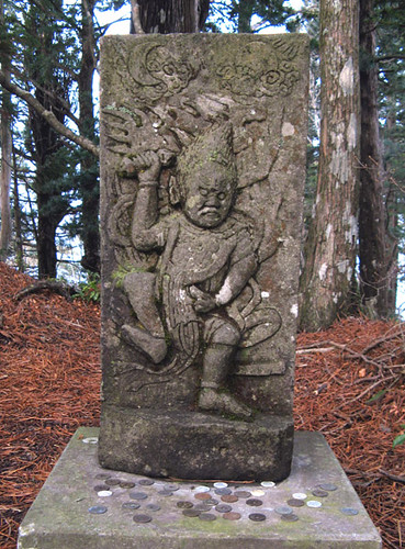
Surprises, like this mountain-top guardian on Mt. Eboshidake, were sometimes encountered.
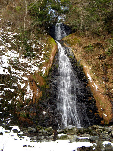
This waterfall was also an incidental discovery, near Mt. Kurodake.
Descending a clearcut on Mt. Yukifuri, a view opens up of Mt. Ryubusa, to be climbed next. Views such as this also helped us with routefinding -- forest roads such as the one visible are often starting points for trails, yet are not always drawn in maps.
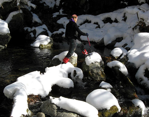
The second week of our explorations, the weather changed and a lot of snow fell on the hills. We had a lot of fun hiking in the snow, something we had not done since we left Canada years ago.
In a few places, trails are equipped with steps and such. While this makes for easier going, such trails are typically set up once and then not maintainted. In a few years, this trail too might go back to the jungle.
This map shows the current status of our ever ongoing Sekiryo explorations. Green lines represent surveyed trails, yellow lines are trails surveyed this winter, and red represents, to the best of our knowledge, trails still left to survey. Blue dots are named and/or significant summits. Exploring these hills is a time-consuming but interesting process, and few things are better for one's mind and body than a hearty walk in the woods. Perhaps when we finish the survey we'll make a hiking map of the area, since none exist at present.
To make full use of the short winter daylight hours, we regularly woke up at dawn. Despite the short driving distance to the trailheads, the approach typically took at least an hour. Narrow, twisty, often unpaved and boulder-strewn roads cannot be traveled quickly. Our car really took a beating, but that was OK because we were about to replace it anyway. Here, morning mists drape the waters and shores of the Kamishiiba reservoir, on the way to snow-covered Mt. Goyuu.
Explorers at work. Equipment included comfortable boots, gaiters (for snow and mud), Goretex coats (the weather was usually unstable), trekking poles, radios (we often split up to explore different trails), and of course, GPS units in waterproof cases. We traveled very light for speed, often not even taking a backpack. But speedy climbing is generally not possible in the Sekiryo hills, due to the rough nature of the trails.
Climbing Sanpou-dake, a typical three-hour hike. Generally, we were able to do two such hikes per day, but when heavy snow fell during the second week, we had to content ourselves with one per day as both car access and the hiking became much more difficult. Although in winter there aren't the vibrant green colors and flowers one can enjoy during the other seasons, the views are better due to the clearer air and bare trees. The GPS also records more accurately withouth the obstructing foliage. Plus there are absolutely no other hikers so parking or crowded trails are certainly not a problem.
Patches of undisturbed forest left here and there on the high ridges are the treasure of the Sekiryo hills. This is what hikers really visit the area for. In the spring and summer, rare flowers can be seen here in great numbers. In the nearby plantations and clearcuts, these plants have now disappeared completely. We're always on the lookout for these natural areas and as we found them, we recorded them dutifully with the GPS. Here, we found an unexpected, naturally open patch on the traverse between Mts. Ishido and Higuchi.
Locating the trails in the first place was a part of the challenge, a kind of treasure hunt really. Some were written up in hiking books, others, to various levels of accuracy and detail, on the internet. Still others we found while hiking, exploring, or driving the forest roads. Occasionally, a useful trail could be gleaned from locally posted maps or signs such as this one.
Trails in the Sekiryo are often not much traveled, and many were difficult to follow. We usually found ourselves following only tape blazes though the trackless woods. Here and there direction signs, in various states of decomposition, also showed the way.
Surprises, like this mountain-top guardian on Mt. Eboshidake, were sometimes encountered.
This waterfall was also an incidental discovery, near Mt. Kurodake.
Descending a clearcut on Mt. Yukifuri, a view opens up of Mt. Ryubusa, to be climbed next. Views such as this also helped us with routefinding -- forest roads such as the one visible are often starting points for trails, yet are not always drawn in maps.
The second week of our explorations, the weather changed and a lot of snow fell on the hills. We had a lot of fun hiking in the snow, something we had not done since we left Canada years ago.
In a few places, trails are equipped with steps and such. While this makes for easier going, such trails are typically set up once and then not maintainted. In a few years, this trail too might go back to the jungle.
Labels: hiking ハイキング
posted by Leanne and Rik Brezina at
2:31 pm
![]()


0 Comments:
Post a Comment
<< Home