Second Annual SHIMO SHIMA CIRCUMNAVIGATION
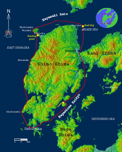
Total distance 121 km
Total time kayaking 23 hours, 15 minutes
Average Speed 5.2km/h
What is starting to seem like an annual ritual, we once again decided to circumnavigate the lower island of Amakusa (Shimo Shima). The story of last year’s circumnavigation can be found on Thursday March 3rd, 2005 at http://vibromama.blogspot.com/2005_03_01_vibromama_archive.html.
This year we decided to do the trip in only 2 days. This was made possible by a careful yearlong observation of the tide currents around the island, months of training, careful study of weather forecasts and LUCK.
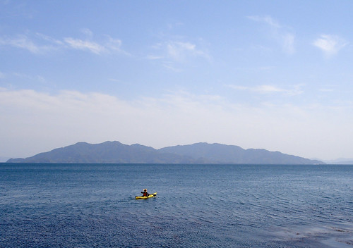
We started at Tomioka Beach near Cape Shikizaki, the northwest extremity of the island at sunrise on Sunday and soon rounded the cape. Here we met with an unexpected annoying current, which set us out on a slow pace.
A couple hours later we entered the fast moving Hayasaki Strait and we were finally cruising at more than 10km/h. This being the end of spring tide we were able to ride the current all the way past Kame island in Oniike. Around here we stayed well away from shore to avoid the back current that swirls around this island. Right in the current convergence zone we often see garbage floating around in circles. Today we found a very unusual site floating around in the water. Upon inspection we found it to be not a pig, but a severely bloated dog.
Turning south toward Hondo we met yet another unexpected back current and a wind, which created waves hampering our forward progress. We finally made it to the Hondo Strait an hour or so behind schedule. As we slid under the Seto Bridge we caught a passing glance at our newly amalgamated Amakusa City, a merging of 2 cities and 7? towns. Along with the merging come elections, and throughout our trip our solitude was interrupted by loud speaker equipped cars repeatedly shouting slogans “My name is Ootsuka Motoo; vote for me!” We felt a little bit of a relief as we passed out of the most densely populated areas of the island; from now on things would also be more scenic.
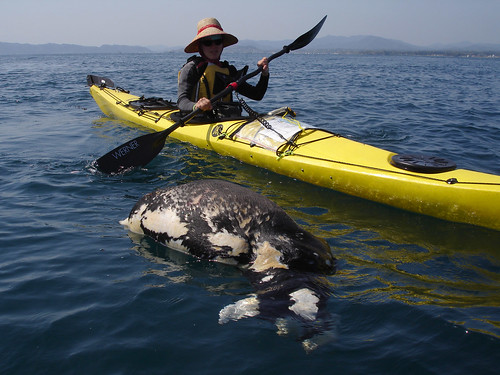
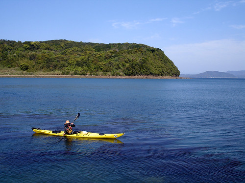
Once past the Hondo we paddled into the Yatsushiro Sea and for a while cruised at a steady pace. Unfortunately, the current started to weaken as we continued and instead of camping at the southern tip of Amakusa, we opted to camp early on Ubu Shima, a beautiful uninhabited island with camping facilities and even hot showers (that were left open for free use!) We felt lucky as we stripped off our heavily salted wetsuits and showered our tired bodies.
We ate a giant dinner of pasta with delicious smoked fish (a souvenir from Yakushima). Although it was delicious, neither of us had a big appetite. In the end it felt like force feeding. We were both so tired and only wanted to sleep, but knowing that tomorrow was going to be a big day we shoved down the grub.
The next day at 3am we started off toward Ushibuka. The sea was calm and we were completely alone paddling down the streaming Nagashima Strait. The moon was bright in the sky casting a slightly blue tinge on the surrounding landscape. For the next 2 hours we made good progress until we approached To Island. Here the tide reversed; this happened a little sooner than anticipated and forced us toward the shore to catch whatever back currents there were. Passing under the Ushibuka Bridge as the sun was rising we focused on moving forward and staying out of the way of fishing boats on their way out to sea. Around Mogushi beach we saw people decked out in full head to toe wetsuits diving for sea urchins.
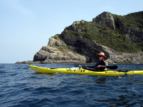
By the time we made it to Cape Oniki, the rocks of the west coast were already dotted with sport fishermen. Sport fishing in Amakusa is big business. These predominately middle-aged males, dressed in the latest hi-tech clothing with fishing gear worth a mint are all transported by boat to these isolated rocks in hopes of catching a prize fish. Along the west coast we also pulled out our fishing rods and begin trawling.
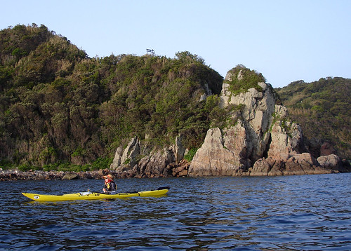
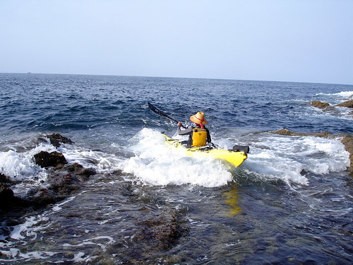
The conditions were ideal; only long slow waves came in from the outside sea causing a comfortable rocking motion. Yet these same waves exploded with great force on the rocky shore making landing on the shore difficult if not impossible. Although there was a slight current against us along the west coast, we proceeded at a good pace.
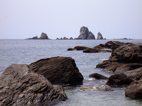
Finally we stopped to make some noodles at the Camellia Park near the Ogase rocks—the symbol of Amakusa’s west coast. Here we refreshed ourselves and psyched up for the final push.
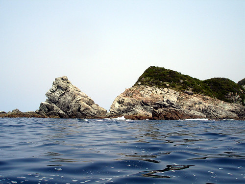
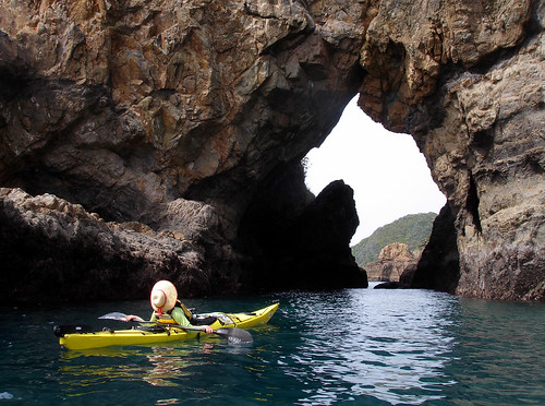
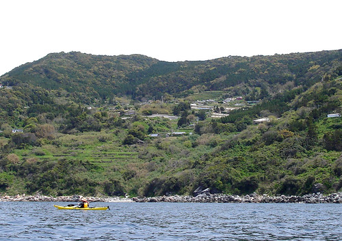
The coastline was beautiful, with twisted rocks, caves, waterfalls fed by recent spring rainfall. Once we passed Shimoda we were even aided by a weak current. Soon we were in Reihoku town giving wide berth to the Reihoku Power Plant. This area of the Shimo Island decided not to amalgamate into Amakusa City because they are independently wealthy due to the ever-expanding power plant. Finally we arrive back at our original departure site, tired but still in good condition. Overall the trip was a success, and we toasted our adventure with a long soak at the local hot spring.
posted by Leanne and Rik Brezina at
12:00 am
![]()


0 Comments:
Post a Comment
<< Home