Yakushima
Trip Statistics according to GPS records:
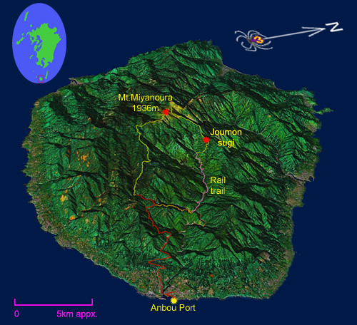
4.0 km walking on the road
7.9 km hiking on the railroad
22.3 km hiking on trail
16.7 km bus ride (one-way)
posted by Leanne and Rik Brezina at
10:27 pm
![]()
Trip Statistics according to GPS records:
4.0 km walking on the road
7.9 km hiking on the railroad
22.3 km hiking on trail
16.7 km bus ride (one-way)
posted by Leanne and Rik Brezina at
10:27 pm
![]()
Gaijin in Japan

Canadians teaching English in Japan

 Subscribe in a reader
1 Comments:
I can't believe how clear it was for you. It's great to see what it really looks like. When Carol and I hike up to Joumon Sugi as well as Mt. Miyanoura we were hiking in thick clouds and downpours. Of course since it rains 8 days a week there we figured it was a very small chance of it being clear.
Good for you guys!
By Anonymous, at 2:26 am
Post a Comment
<< Home