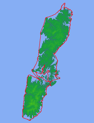
TSUSHIMA CIRCUMNAVIGATION

With the Korean Peninsula close to the north, the large Japanese island of Kyushu to the south, the East China Sea to the west, and the Japan Sea to the east, the Tsushima archipelago does not enjoy a very stable position, be it from the point of view of weather, sea currents, or even human civilization. Storms descending from the Asian continent batter the islands with cold winds in the winter and spring, and typhoons that have not yet lost strength by encountering land occasionally blow in from the south-west during summer and fall. The waves and tides of the two seas don't often match, creating confused currents and rips around the exposed points of the coast. The civilizations on either side have not exactly mixed well either, and although for a time Tsushima was an important trading point between China and Japan, there were also territorial squabbles and today the coasts are heavily patrolled by the Japanese Coast Guard and Self-Defense forces. With South Korea's coast less than 60km away, the northern tip of Tsushima is one of only three points where foreign land can be seen from Japan, and this seems to make the authorities uneasy.
For the casual explorer, these facts make Tsushima an interesting place to visit. Loosely translated, the first week of May is called in Japan 'the big string of holidays' and this year for most folks this amounted to three days off during the middle of the week (with work on Monday and Friday). During this time certain places recognized for their sightseeing value get jammed beyond belief by visitors with exactly synchronized schedules. Such places are prudent to avoid, but others, equally scenic, remain just as deserted as ever. This year we were lucky to get 10 days off work and gambled on Tsushima to be in the latter category. We were not disappointed. We planned a tour circumnavigating the archipelago, covering a distance of about 250km; this is very reasonable in 10 days if the weather cooperates, but we weren't counting on that. Fortunately, due to the elongated shape of the islands, in bad weather usually only the west or the east coast becomes unnavigable. In the middle, a sheltered bay called Asou-wan exists, as well as two very narrow passages linking the two coasts. With this strategic information, a long-range weather forecast, and, we hoped, a little luck, we planned to travel always sheltered from the storm.


0 Comments:
Post a Comment
<< Home